- AI simulation gives Carolina Hurricanes 20% chance to win 2026 Stanley Cup
- Warf steps down as president of Carolina Hurricanes
- Tornado in North Dakota was the first at EF5 strength in a dozen years
- Eric Tulsky comfortable, confident and going for the Stanley Cup in 2nd year as Hurricanes GM
- 5 homes collapse into the surf of the Outer Banks as hurricanes rumble in Atlantic
Severe thunderstorms potential brings hail, damaging winds to Central Texas
Large hail and damaging winds possible in San Antonio area.
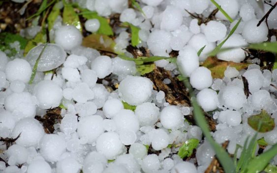
Luis Diaz Devesa/Getty ImagesWhile weather conditions remained mostly optimal throughout Fiesta, there is now some potential for storms. Following thunderstorms in San Antonio the night of Sunday, April 10, the National Weather Service issued notice of potential severe weather across Central Texas on the morning of Monday, April 11.
While the potential for severe storms in San Antonio is marginal, if they do form, they are expected to include large hail and damaging winds. The chance of storms across Central Texas is projected to increase for some areas (particularly in the northeast) on Tuesday, April 12.
From 3 to 9 p.m. on Monday, a marginal risk for severe weather will persist over the eastern Hill Country and I-35 corridor. On Tuesday, a marginal to enhanced risk of severe weather will occur between noon and midnight across Central Texas, the Hill Country, and along I-35 and I-37.
On Tuesday, the National Weather Service writes, that along with risk for large hail and strong winds, “an isolated tornado can’t be ruled out.” Wednesday will bring a return to critical fire weather conditions across the area.
Read more from Camille
– This is how San Antonio’s now-extinct paper boys celebrated Christmas
– Revved up for more: What I learned from my first Monster Jam experience in San Antonio
– San Antonio ramen shop Kimura gets a second act at Five Points Local
Keep up with the latest and sign up for our MySA newsletters here.