- Why no hurricanes made landfall in the US in 2025
- Florence to begin interviewing police chief finalists in January
- A West Texas county wants to better prepare for floods. Paying for it will be tricky.
- They couldn’t save their daughters’ lives in the July 4 floods. Now they’re dealing with the grief and the guilt.
- Austin could see heavy rains, possible flooding over the next few days
Weather IQ: A bird's eye view of hurricanes
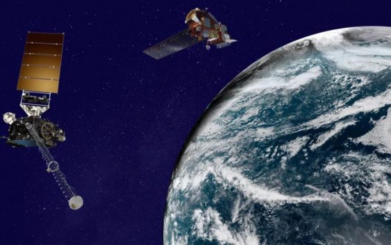
From formation to landfall, weather satellites allow meteorologists to better forecast tropical storms and hurricanes.
CHARLOTTE, N.C. — Thousands of satellites are currently orbiting planet Earth, including some used to track major weather events. Like another set of eyes orbiting 22,000 miles above the Earth’s equator, meteorologists rely on these tools to help them provide accurate and timely forecasts — especially during the hurricane season.
“Before we had satellites, we used to sometimes send aircraft out – reconnaissance aircraft out maybe to find the tropical waves, try to find storms, that’s why they are called hurricane hunters. They literally used to hunt for these storms,” Dan Brown with NOAA’s National Hurricane Center explained. “Now with satellites, we’re able to monitor around the clock, each day, where these waves are located [and] if that thunderstorm activity is becoming more organized, and if that system might go on to develop.”
Without satellites, observations over the remote locations of the Atlantic Ocean would be limited to aircraft or ships. Land-based weather radars have a maximum range of nearly 150 miles. The usefulness of radar beyond that range is exceeded.
Areas of potential tropical development
Satellites are constantly scanning the plant. To monitor for potential tropical development, satellites scan key areas, including the Gulf of Mexico, the Caribbean Sea, and the rest of the Atlantic Ocean extending to the western coast of Africa.
Types of weather satellite images
There is a variety of imagery produced by weather satellites. Three of the most common satellite imagery are called:
- Visible
- Infrared
- Water Vapor
Visible satellite imagery
Visible imagery can only be seen during the day because it observes reflecting sunlight from the Earth’s surface.
Infrared satellite imagery
Infrared images can be used at both day and night since infrared doesn’t rely on sunlight. Instead, its sensors measure heat that radiates from the clouds.
Water vapor satellite imagery
Water vapor imagery helps indicate where heavy rain is possible based on the amount of moisture in the upper atmosphere.
Scanning the skies
The Western Hemisphere is scanned every 15 minutes, the continental United States every five minutes, and GOES-16 can provide images of severe weather every 30 seconds, as needed. (GOES-16 is one of two full-time geostationary satellites parked over the United States that jointly scan the country and adjacent coastlines.)
Intensity measurement
“We at the hurricane center, we use one [satellite]