- Even light rain causing flash flooding issues on Houston's north side
- LIST: High water locations, street flooding as heavy rain falls in the Houston area
- China on Alert for Heavy Rain and Floods From Typhoon Gaemi
- Flash flood threat; A day to be Weather Aware
- Power-Thirsty Bitcoin Miners Are Flooding the Energy Center of Texas
Later today: Strong winds, heavy rain, isolated tornadoes
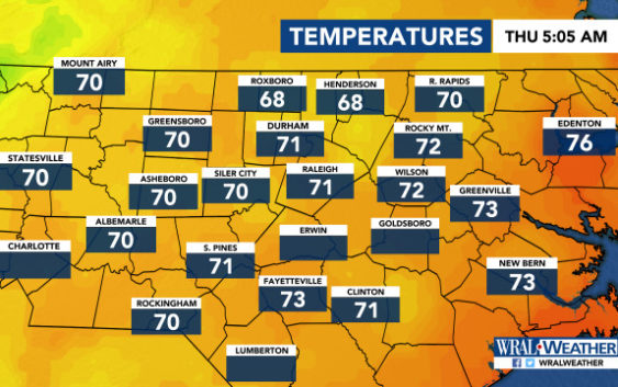
Raleigh, N.C. — It could rain for most of Thursday, according to WRAL meteorologist Elizabeth Gardner, and most of the state is under a risk for severe storms.
According to Gardner, damaging winds, heavy downpours, isolated tornadoes and lightning are most likely late afternoon and in the evening.
The entire viewing area is under a level 1 risk for severe weather.
“Wind damage will be our biggest threat, but tornadoes are not out of the question,” said Gardner.
A 40 percent chance for rain will remain all day, and that chance increases to 60 percent by 8 or 9 p.m., said Gardner. Highs will be in the upper 70s or low 80s.
Thursday’s gray forecast doesn’t mean the weekend will be rained out, though.
Friday will see scattered storms and showers on and off, and Saturday and Sunday will be partly cloudy but clear, with warmer temperatures and little chance for rain.

“Saturday and Sunday look beautiful, but Friday looks iffy,” said Gardner.