- Houston Cougars take on A&M Aggies in charity exhibition game supporting Hurricane Beryl relief
- Hurricane Helene donations delivered to Avery County for Share the Warmth campaign
- Old Crow Medicine Show founder talks music, hurricane relief and this weekend's big benefit show
- IV fluid shortage caused by hurricane to last for months
- 'It financially annihilated us': Pregnant mother displaced for 2nd time after western NC floods
Florence's damage to Brunswick Superfund site resembled Cat 3 storm
Officials said there was no increased risk of contamination, just downed trees and minor flooding at the Navassa site
BRUNSWICK COUNTY — The agencies responsible for cleanup of the 254-acre Kerr-McGee Superfund site along the Brunswick River in Navassa said that despite being battered by winds and seeing some flooding, the site emerged from Hurricane Florence relatively unscathed.
“There didn’t appear to be any real damage to the site in terms of access to contaminants, so there’s no increased exposure caused by the storm,” said Richard Elliott, the project manager for the Mutlistate Environmental Response Trust, which is managing cleanup and reuse of former Kerr-McGee sites across the country along with the U.S. Environmental Protection Agency (EPA) and state governments.
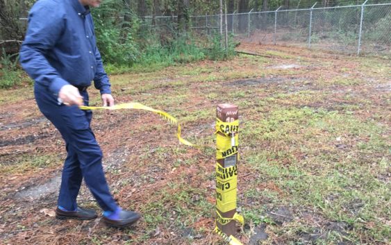
Last Thursday, downed trees could be seen in several areas throughout the site, and EPA officials pointed to a spot on the site’s southern end, near Sturgeon Creek, where water had risen around metal poles marking well sites. Florence’s flooding, Elliott told a group of citizens and town officials, aligned closely with predictions for what would happen to the site in the event of a Category 3 hurricane.
The site is bordered by the Brunswick River to the east and Sturgeon Creek to the south, which made it appealing for Kerr-McGee to set up a wood treatment site there in 1936 that remained in operation until 1974. The treatment involved creosote, though, which leached into soil and groundwater.
Erik Spalvins, the site’s EPA remedial project manager, said that while local contractors checked on the site before and after the storm, there was not significant risk of the storm worsening contamination.
“This Superfund site is in pretty stable condition,” Spalvins said. “There’s not ongoing construction, there’s not operating equipment on a daily basis, so this was a very low risk for any kind of new release.”
The EPA used National Oceanic and Atmospheric Administration (NOAA) satellite imagery to check on the site and make sure a staging area where they and contractors have stored equipment remained unharmed during the storm. Locking plugs were also fitted inside each of the site’s 53 monitoring wells to ensure floodwaters couldn’t get in or out.
Both the EPA and the trust have identified a 50-acre parcel on the site’s northwest corner as the likely location of the first remediation efforts. The area is lightly contaminated and, Spalvins said, could be used within two or three years.
Elliott and Spalvins both also expressed interest in using the site’s official record of decision to remove 100 uncontaminated acres on its eastern side from the Superfund program.
Spalvins said the trust has also sent the EPA and the U.S. Department of Justice the outline of the site’s marketing plan. He also noted that developer interest could influence how the site is cleaned up, with residential uses, for instance, demanding more significant remediation than commercial options.
Elliott, of the trust, said there has been significant interest in the Navassa site. Of eventually marketing the site, he said, “You try to look for people that are experienced with dealing with Superfund sites because there are stigmas associated with them. The property will be cleaned up, so it’s not really a real problem, but it’s more of a perceived problem.”
Several Navassa council members present at last Thursday’s meeting questioned when they would need to pass zoning regulations for the site and asked how they could ensure it would abide by one of a quartet of conceptual plans formed by the town’s citizens and government.
In response to one question, Elliott said, “I want it to be legally binding, I want it to be something that meets the needs of the community, but I want to give the developer as much latitude as they can.”
Reporter Adam Wagner can be reached at 910-343-2389 or Adam.Wagner@GateHouseMedia.com.