- Springfield Middle School to receive new mobile classrooms following tornado damage
- Several Raleigh homes damaged by fire caused by lightning strike
- Three Raleigh homes damaged by fire caused by lightning strike
- Carolina Hurricanes forward Jesper Fast expected to miss season after neck surgery
- New AI system helps Central Texas first responders detect wildfires as they happen
Forecasters: ‘Potentially historic’ flooding threatens South
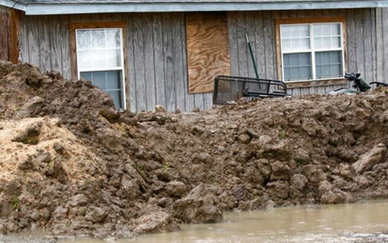
Scientists are warning that historic flooding could soon deluge parts of several Southern states along the lower Mississippi River, where floodwaters could persist for several weeks.
The flood threat in the South will be discussed Thursday, when the National Oceanic and Atmospheric Administration releases its 2019 spring outlook. Experts plan a briefing on their flood forecast at the National Water Center in Tuscaloosa, Alabama.
Thursday’s report is aimed at helping emergency managers and other safety officials to prepare for flooding.
Flooding in Southern states this spring will be “potentially historic,” NOAA said in an advisory.
Sign Up and Save
Get six months of free digital access to The News & Observer
#ReadLocal
Rapidly melting snow in the upper Midwest is contributing to flooding that will eventually make its way downstream to the Gulf Coast, forecasters have said.
The expected surge of water from the north is unwelcome news in parts of Mississippi. In the western part of that state, the Mississippi River is already swollen and has been flooding some communities unprotected by levees since last month.
One Mississippi region protected by levees is also flooding. That’s because smaller rivers can’t drain into the Mississippi River as normal because a floodgate that protects the region from even worse flooding by the big river has been closed since Feb. 15.
Around Rolling Fork, Mississippi, townspeople first noticed water rising from swamps near the Mississippi River in late February. The water eventually invaded some homes in that community, about 40 miles (65 kilometers) north of Vicksburg.
Major flooding is already occurring this week on the Mississippi River near several Southern cities including Arkansas City, Arkansas; Natchez, Mississippi; and Baton Rouge, Louisiana, according to river gauges and data from NOAA.