- EF-1 tornadoes ripped through Cypress, Waller County areas with winds at more than 100 mph, NWS reports
- Houston-area storm damage updates: Clean up continues after NWS says two EF-1 tornadoes and powerful derecho ripped through SE Texas
- Low risk of damaging winds, hail from Saturday storms
- EF 1 tornadoes ripped through Cypress, Waller County areas at more than 100 mph, NWS reports
- Caddo Mounds State Historic Site to celebrate new visitor center, traditional grass house after 2019 tornado
Storm moving across the country with rain, severe weather for central US
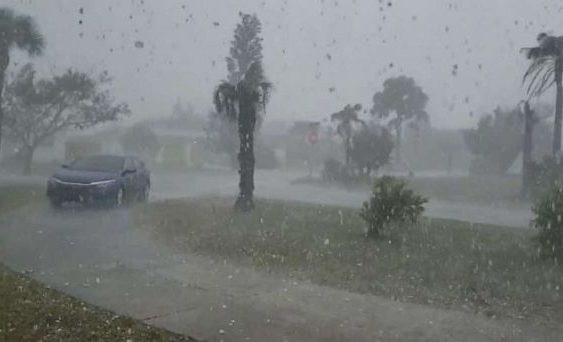
A storm that brought hail the size of golf balls to Florida on Wednesday has moved out and now we are watching our western storm to cross the country and bring more severe storms, heavy rain and even snow!
Unsettled weather stretches from the West Coast all the way to the Midwest on Thursday morning with heavy rain and snow.
Heavy snow has been falling on Interstate 80 in California over the Donner Summit where traffic has come to a standstill.
The rain will continue through the flooded areas of the Plains through Thursday, but it is not expected to be very heavy.
By Friday afternoon and evening, a stronger storm will move into the central U.S. with heavy rain and severe storms to the south and snow to the north.
A widespread region from Kansas to Indiana is expecting 1 to 2 inches of rain, with localized amounts near 3 inches.
To the north and west, more than half a foot of snow is expected in Wyoming — and even a few inches are possible in the High Plains or Nebraska.
Ahead of the storm, a nice warmup has arrived for most of the East.
Highs on Thursday will surge near 60 degrees in Chicago and Detroit, while the warmth will move to the East Coast by Friday and Saturday.
The forecast is for 60s and 70s from Washington, D.C., to Boston.
Copyright © 2019 ABC News Internet Ventures.