- Flooding lingers in Liberty County neighborhoods near Trinity River with more rainfall expected
- North Carolina behind on hurricane preparedness, study shows
- North Carolina way behind on hurricane preparedness, study shows
- New hurricane preparedness report doesn't rank North Carolina well
- New hurricane preparedness report doesn't rank North Carolina well
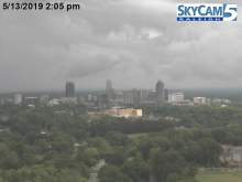
More severe weather moving through central NC

Raleigh, N.C. — A second round of severe weather is moving through central North Carolina, just hours after a line of storms marched through parts of the state, knocking down trees, toppling power lines and dumping several inches of rain throughout the region.
A tornado warning was issued for Wilson County, and WRAL meteorologist Mike Maze said the line of severe weather stretched from Micro to Selma along Interstate 95.
Maze said hail, torrential downpours and lightning was possible from the storm.
The first round of turbulent weather rolled through mid-morning Monday.
Parts of Zebulon seemed to have been hit the hardest during that first round. Live pictures from Sky 5 showed several areas of debris, and one home seemed to have been virtually demolished.
No injuries have been reported so far.
There were several building with heavy damage to their roof and there were several fields with fallen trees that were felled by winds and rain.
As of 1 p.m., there were still several counties under a severe thunderstorm watch or warning until 4 p.m. Monday, including Johnston, Martin, Pasquotank, Pitt and Washington.
Wake County and some areas east of it remained under a Level 2 risk of severe weather until 1:30 p.m. Hail, gusty winds and heavy rain was possible. At the height of the storm, nearly 7,000 people were without power in Wake, and there were other widespread power outages in Chatham, Nash and Franklin counties.
Subscribe to get weather alerts on your device.
Updates
12:06 p.m.: Sydney Perry, a homeowner in Zebulon, said he heard a train sound, and he and his wife headed to their bathroom to take cover. They were in there for only five minutes as the storm sped through. Five or six trees on his property were damaged in the storm.
“We were lucky,” he said. “It tore all the trees down but the house is OK.”
11:49 a.m.: N.C. Highway 97 was closed near in Zebulon at Industrial Drive, N. Gill Street and Currin Perry Road due to downed trees.
Brantley Road in Nash County was also closed due to downed trees.
11:43 a.m.: The worst of the storm is now out of downtown Wilson, Gardner said. The sun was out and bright at the WRAL-TV studios in Raleigh and east of Raleigh in Wendell less than an hour after severe weather passed through.
Several homes near Edgemont Road and Doc Proctor Road in Wendell were significantly damaged in the storms. The National Weather Service has not confirmed a tornado in the area, but conditions resemble one.
11:35 a.m.: A strong storm cell is beating down on Wilson as the system shifts eastward, according to Gardner. Strong, gusty winds, hail and heavy rain are all possible. There are no current tornado warnings in North Carolina.
“But you really want to be careful in this area,” Gardner said.
Structure and tree damage was reported near Pilot in Surry County. Drivers traveling east of Raleigh should be cautious and prepared for delays, according to WRAL Brian Shrader.
In Nash County, Middlesex and Bailey were also seeing significant damage. No injuries were reported.
11:25 a.m.: One lane of U.S. Highway 64 has reopened near Lizard Lick Road after a tree fell onto the roadway. Many people around the Lizard Lick area will be left with significant cleanup. Photos posted on Twitter showed trees split in half, trees covering a backyard and even a damaged garage.
Reports show over 1.5 inches of rain fell near Nashville over a span of only a few hours, and nearly 2 inches fell north of Zebulon.
11:20 a.m.: 6,600 customers were without power in Wake County, the latest numbers from Duke Energy show.
The strong storms that downed trees and power lines in eastern Wake County are now passing through Edgecombe County near Tarboro and Pine Tops, Gardner said. The worst is over for the Triangle.
11:12 a.m.: Most storm cells that once threatened eastern Wake County appear to be weakening, according to Gardner.
11 a.m.: 7,634 customers in Wake County were without power at 11 a.m. 1,613 were without power in Chatham County. About 850 had lost power in Nash and 768 people were without power in Franklin.
Significant tree damage was visible from U.S. Highway at 264 at Lizard Lick Road, where a tree landed on top of a car.
A line of powerful storms was moving east, largely affecting eastern Wake County near Wendell, Knightdale and Middlesex. Large hail and tree damage was reported.
10:56 a.m.: Wake County is seeing the heaviest rain, according to Gardner. The strongest part of the storm is headed out of Raleigh and off to the east toward Garner, Wendell and Knightdale.
“The real threat is over for Raleigh,” Gardner said.
10:46 a.m.: The tornado warning for Nash and Wilson counties was canceled. Severe weather and heavy rain continue to move through the area.
“There is no longer a tornado warning, but it’s likely that trees could come down,” said Gardner.
Fire crews were responding to a tree down on a vehicle on Lizard Lick Road just south of U.S. Highway 64.
10:45 a.m.: Residents of north of Bailey and south of Spring Hope should take cover, according to Gardner.
Large hail was reported in Cary and Morrisville.
The strongest part of the storm has moved out of downtown Cary and east toward Raleigh. “The storm is headed for Hillsborough Street and will soon pass over the WRAL-TV station,” said Gardner.
10:33 a.m.: The tornado warning was canceled for Wake and Johnston counties. Nash and Wilson counties remain under a tornado warning.
10:30 a.m.: Trees and power lines were reported to have fallen on Davis Town Road, north of Wendell and east of Rolesville. Rolesville High School and Rolesville Middle School tweeted that they are sheltering in place as severe weather moves through.
Pea-sized hail was reported in downtown Rolesville.
10:15 a.m.: A severe thunderstorm warning is in effect for Chatham, Durham, Orange, and Wake counties until 10:45 a.m. A severe thunderstorm warning is in effect for Franklin and Wake counties until 10:30 a.m.
“We’re probably going to see more and more of this over the next few hours, then we will be through with this,” Gardner said, adding that the pockets of rain passing through northwest Wake County are small but powerful.
The rest of the week
By the evening, a dry cold front will have passed through central North Carolina, leaving cooler and less humid air.
“Cooler and less humid air will really arrive tonight and tomorrow,” Gardner said.
According to WRAL meteorologist Kat Campbell, it will be the end of the week before Raleigh sees temperatures over 80 degrees again.
Tuesday will be mostly sunny and comfortably cool with highs in the upper 60s to mid-70s. But the cooler days also mean cooler nights.

By Wednesday morning, the low temperature could dip into the 40s. “You’ll want an extra layer as you leave the house,” Gardner said.
A gradual temperature resurgence begins Wednesday.
While some clouds return for Thursday through the weekend, they will serve only to provide relief as the temperatures climb back into the mid-80s by Friday or Saturday.
After Monday, there is no rain in the forecast for the week.

“Could we finally break the rainy weekend streak? For now Saturday is looking dry with highs in the mid 80s and partly cloudy skies,” Campbell said.