- San Antonio officials warn residents to stay vigilant ahead of possible Thursday nights floods
- Possible heavy downpours and flooding in Hill Country counties | Weather Impact Alert
- Severe weather leads to fallen trees, car crashes and flooding around the Triangle
- New video shows vehicles being swept away in historic, deadly flash floods in SA on June 12
- $40 million to go to underserved SC counties for Hurricane Helene recovery. Here's what you need to know.
The latest: Tornado warning in effect for Nash and Wilson counties, hail and damage reported
Raleigh, N.C. — WRAL News is tracking a line of severe weather moving through central North Carolina late Monday morning.
Overview
A tornado warning is in effect for Johnston, Nash, and Wilson counties until 11 a.m. Heavy rain, hail, gusty winds and lightning are possible as the rough weather moves through.
“You need to be prepared to take cover,” said WRAL meteorologist Elizabeth Gardner. “It does not look like the storm is weakening.”
Updates
10:33 a.m.: The tornado warning was canceled for Wake and Johnston counties. Nash and Wilson counties remain under a tornado warning.
10:30 a.m.: Trees and power lines were reported to have fallen on Davis Town Road, north of Wendell and east of Rolesville. Rolesville High School and Rolesville Middle School tweeted that they are sheltering in place as severe weather moves through.
Pea-sized hail was reported in downtown Rolesville.
10:15 a.m.: A severe thunderstorm warning is in effect for Chatham, Durham, Orange, and Wake counties until 10:45 a.m. A severe thunderstorm warning is in effect for Franklin and Wake counties until 10:30 a.m.
Subscribe to get alerts on your device
“We’re probably going to see more and more of this over the next few hours, then we will be through with this,” Gardner said, adding that the pockets of rain passing through northwest Wake County are small but powerful.
By the evening, a dry cold front will have passed through central North Carolina, leaving cooler and less humid air.
“Cooler and less humid air will really arrive tonight and tomorrow,” Gardner said.
According to WRAL meteorologist Kat Campbell, it will be the end of the week before Raleigh sees temperatures over 80 degrees again.
Tuesday will be mostly sunny and comfortably cool with highs in the upper 60s to mid-70s. But the cooler days also mean cooler nights.
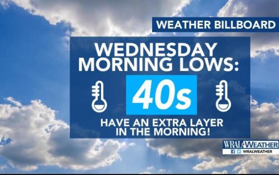
By Wednesday morning, the low temperature could dip into the 40s. “You’ll want an extra layer as you leave the house,” Gardner said.
A gradual temperature resurgence begins Wednesday.
While some clouds return for Thursday through the weekend, they will serve only to provide relief as the temperatures climb back into the mid-80s by Friday or Saturday.

After Monday, there is no rain in the forecast for the week.
“Could we finally break the rainy weekend streak? For now Saturday is looking dry with highs in the mid 80s and partly cloudy skies,” Campbell said.