- Tropical Storm Melissa lumbers through the Caribbean as islands take cover from rain
- Tropical Storm Melissa brings flood risk to Haiti, Dominican Republic and Jamaica
- Army Corps evaluates Wrightsville Beach storm damage; could accelerate re-nourishment plans
- Austin and Travis County issue disaster declaration as wildfire risk rises
- Raleigh rethinks how to grow as flooding, heat and traffic worsen
Strong storms with damaging winds, lightning possible Friday
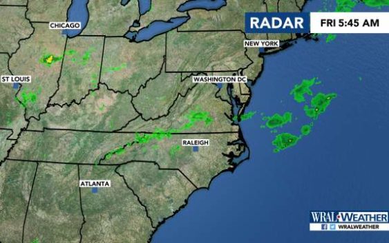
Raleigh, N.C. — After a string of hot but quiet days, the Triangle and eastern areas are under a slight risk for severe storms on Friday.
Durham, Raleigh, Fayetteville and eastward are under a level 2 risk for severe weather as a cold front moves in.
Those areas could see damaging winds, lighting and some hail, meteorologist Elizabeth Gardner said.
Western areas are under a level 1 risk, or marginal risk, according to the U.S. Storm Prediction Center.
“Anywhere has the potential for showers and storms today,” Gardner said.
The system comes after areas south of Fayetteville saw downed trees and damaged buildings after storms Thursday night.
Showers could pop up around lunchtime Friday, and around 2 or 3 p.m., storms are expected to develop.
Those storms will continue into the evening, with even more clusters of severe weather developing around 8 p.m.
Most will move east out of our area by midnight.
Temperatures will reach 90 degrees on Friday.

There’s a 30 percent chance of rain on Saturday as Friday’s cold front stalls. The high will be 87 degrees.
Sunday has another 30 percent chance of rain, with temperatures reaching 88 degrees.
Temperatures are expected to stay in the 80s next week.
