- EF-1 tornadoes ripped through Cypress, Waller County areas with winds at more than 100 mph, NWS reports
- Houston-area storm damage updates: Clean up continues after NWS says two EF-1 tornadoes and powerful derecho ripped through SE Texas
- Low risk of damaging winds, hail from Saturday storms
- EF 1 tornadoes ripped through Cypress, Waller County areas at more than 100 mph, NWS reports
- Caddo Mounds State Historic Site to celebrate new visitor center, traditional grass house after 2019 tornado
FORECAST: Hurricane Barry and Afternoon Storms
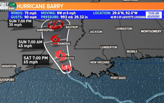
HURRICANE BARRY: Barry officially became a hurricane when peak winds registered at 75 mph (a low-end category 1 hurricane). These hurricane winds were in only a small section east of the central circulation. Barry officially made landfall around the Vermillion Bay afternoon. The major threats now that it is making landfall are the intense rain through the weekend and the already quickly rising storm surge. Storm surge is already up to 7 feet in some areas. This will be an ongoing story as it slowly trudges north through the weekend!

WEATHER WCNC
Here locally, we have yet again another chance for showers and storms to develop during the afternoon. The general rule of thumb today will be the further south you go, the more likely you will see rain! This line will develop this afternoon and will taper off in the evening like yesterday.
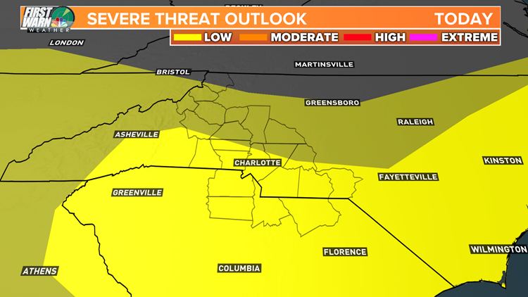
NOTE: We do have a low risk for severe storms today (yellow below). This is due to the prime environment for wet microbursts (isolated damaging winds).
WEATHER WCNC
Also, heavy rain will fall along with some thunderstorms that could lead to some brief flooding. Not everyone will see storms today.
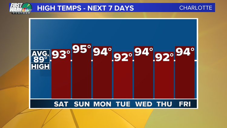
Tomorrow has the best chance to stay dry over the next few days. It will be a hot day in the mid 90’s though feeling close to 100° (which is becoming a familiar story).
Come next week we will keep an isolated pop-up thunderstorm chance around most days with highs every day staying slightly above average in the low 90’s feeling like the mid to upper 90’s.
WEATHER WCNC
Enjoy the rest of your day and have a wonderful weekend!
.
Copyright 2018 WCNC