- Why no hurricanes made landfall in the US in 2025
- Florence to begin interviewing police chief finalists in January
- A West Texas county wants to better prepare for floods. Paying for it will be tricky.
- They couldn’t save their daughters’ lives in the July 4 floods. Now they’re dealing with the grief and the guilt.
- Austin could see heavy rains, possible flooding over the next few days
Tracking Hurricane Dorian: Coverage along the coast and across North Carolina
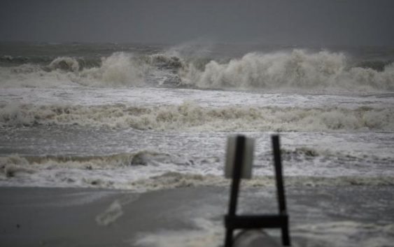
Hurricane Dorian finally made itself felt in North Carolina on Thursday, Sept. 5, 2019, after almost a week of varying forecasts and a slow march north and west.
Ahead of the storm, 12 North Carolina counties ordered evacuations and all residents and visitors were urged to leave the Outer Banks.
Hurricane Dorian was expected to skirt the North Carolina coast near Wilmington with winds of up to 105 mph before making a turn out into the Atlantic.
The storm brought hours of rain and whipping winds as far inland as Interstate 95, and spurred suspected tornadoes from Myrtle Beach, SC, to the Crystal Coast and in Wayne County near Mar-Mac.
Find coverage of your community on the map below, or keep scrolling for all of WRAL’s stories and video as Hurricane Dorian passes.