- $40 million to go to underserved SC counties for Hurricane Helene recovery. Here's what you need to know.
- Family honors Air Force veteran Derwin Anderson Jr. after he died in June flash floods
- City of Wilmington addresses flooding on New Centre Drive
- Harnett County fire: Two homes damaged
- Medical examiner identifies 13th victim from massive flash flood in San Antonio
Tracking Hurricane Dorian: Coverage along the coast and across North Carolina
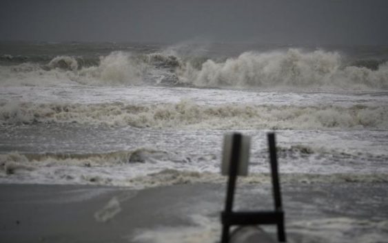
Hurricane Dorian finally made itself felt in North Carolina on Thursday, Sept. 5, 2019, after almost a week of varying forecasts and a slow march north and west.
Ahead of the storm, 12 North Carolina counties ordered evacuations and all residents and visitors were urged to leave the Outer Banks.
Hurricane Dorian was expected to skirt the North Carolina coast near Wilmington with winds of up to 105 mph before making a turn out into the Atlantic.
The storm brought hours of rain and whipping winds as far inland as Interstate 95, and spurred suspected tornadoes from Myrtle Beach, SC, to the Crystal Coast and in Wayne County near Mar-Mac.
Find coverage of your community on the map below, or keep scrolling for all of WRAL’s stories and video as Hurricane Dorian passes.