- EF-1 tornadoes ripped through Cypress, Waller County areas with winds at more than 100 mph, NWS reports
- Houston-area storm damage updates: Clean up continues after NWS says two EF-1 tornadoes and powerful derecho ripped through SE Texas
- Low risk of damaging winds, hail from Saturday storms
- EF 1 tornadoes ripped through Cypress, Waller County areas at more than 100 mph, NWS reports
- Caddo Mounds State Historic Site to celebrate new visitor center, traditional grass house after 2019 tornado
Weather radar: Tornado warnings expire, but severe thunderstorm warnings remain
RALEIGH (WTVD) — Parts of the ABC11 viewing area are under a Category 3 “enhanced” risk for severe weather Thursday.
Current Warnings and Watches:
Tornado warning: All tornado warnings have expired.
Severe Thunderstorm Warning: Nash, Edgecomb, Halifax, Wilson counties until 3:45 p.m.
Tornado watch: Entire Central North Carolina until 7 p.m.
Watch for live updates on these watches and warnings in the video player above.
Timelapse of severe weather moving through Durham
What’s the difference between a watch and a warning
Some schools even dismissed early as severe weather moved in to the area.
Click here for First Alert Doppler XP | Click here to view the latest weather advisories.
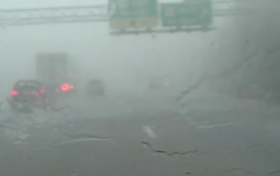
SEVERE WEATHER TIMELINE
Light and moderate rain moved into central North Carolina in the early morning hours.
The first severe weather warnings for the ABC11 viewing area began around 12:15 p.m. Chances remain rather high for severe weather in the area through 7 p.m.
The storms could bring heavy rain, damaging wind and isolated tornadoes.
Areas west of Interstate 95 are under a Flood Watch through late Thursday night.
The storms will last through the afternoon and evening. They will move out of central North Carolina overnight.
After the storms, temperatures will briefly cool down — with a chance for below-freezing temperatures overnight Friday into Saturday morning. We will warm up by Monday and another chance of showers arrives Tuesday.
Copyright © 2020 WTVD-TV. All Rights Reserved.