- The deadliest tornadoes to ever hit Austin
- Whiteville resident recalls events from Tuesday nights tornado
- Tornado damage reported in southern NC after Tuesday's severe storms
- If your home floods, here are steps you can take to address mold
- WATCH: Video Shows Confirmed Tornado touches down in Columbus County
LIVE: Severe storms possible overnight, tornado watch for most of Central Texas until 8 a.m.
AUSTIN, Texas — A Tornado Watch has been issued for most of Central Texas until 8 a.m. Sunday morning. Storms between now and 8 a.m. may be capable of tornadoes, large hail up to tennis ball size, and damaging wind gusts up to 70 mph.
Watches and Warnings
3:50 a.m.: A Severe Thunderstorm Warning has been issued for parts of Burnet, Gillespie and Llano counties until 4:45 a.m.
4:30 a.m.: Tornado Warning has been issued for Llano County
Background
After a few showers and downpours on Saturday afternoon, the severe weather potential is now expected to ramp up across Central Texas Saturday night.
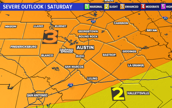
The Storm Prediction Center (SPC) has outlined the enhanced level – 3 out of 5 – risk for severe storms for all of Central Texas. The main window for severe storms will come between midnight and 8 a.m. on Sunday morning.
Storms during this time frame may be capable of damaging wind gusts, large hail and isolated tornadoes.

kvue
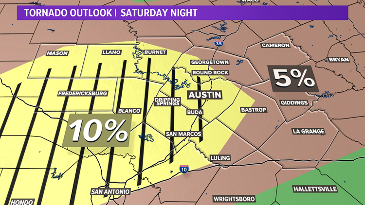
The SPC has highlighted areas south and west of the Interstate Highway 35 corridor for an enhanced tornado risk on Saturday night.
In the yellow hatched area seen below, a strong, long-track tornado is possible.
KVUE
Timeline
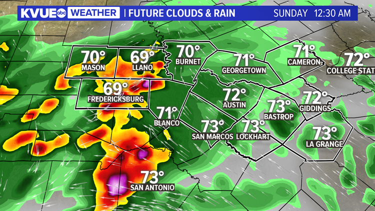
The window for severe storms will open up at midnight, with storms first developing across the Hill Country.
KVUE
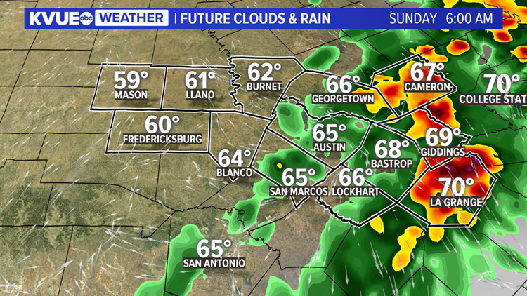
Storms will push eastward through the late overnight, and it looks like storms may first move into Travis County and I-35 corridor by about 3 a.m.
Any of these embedded thunderstorms may be capable of damaging winds, large hail and a few tornadoes. Again, the highest tornado risk will be south and west of the I-35 corridor, where a strong, long-track tornado cannot be ruled out.
KVUE
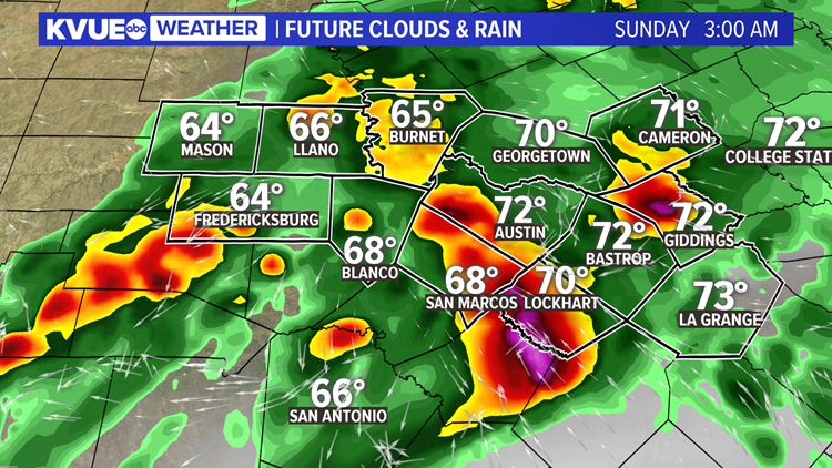
Although the tornado risk is a bit lower east of I-35, the severe weather risk will continue as storms push east of Austin by 7 a.m. on Sunday morning.
Storms will move out of Central Texas by about 8 a.m. on Sunday morning.
KVUE
After sunrise on Easter Sunday, a much quieter weather pattern moves in with a strong westerly wind for the afternoon.
Clearing will take place through the day with sunshine for the afternoon and highs in the low 80s.

KVUE
Expect cooler temperatures and drier weather for the upcoming week. The extended forecast can be found below.
For the latest weather alerts sent straight to your phone, be sure to download the KVUE app.
PEOPLE ARE ALSO READING:
Coronavirus updates in Central Texas: Texas Gov. Greg Abbott to issue executive order next week
LIST: Austin restaurants selling grocery items
State health worker tests positive for coronavirus, according to internal email