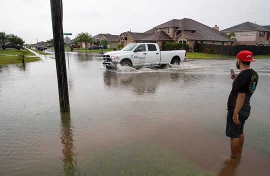
- 'She will be greatly missed': Memorial service held for 77-year-old woman killed in SA floods on June 12
- San Antonio officials warn residents to stay vigilant ahead of possible Thursday nights floods
- Flooding is possible in South Texas as we head into July 4th. Here's where.
- Flood Watch issued for counties west of San Antonio | Weather Impact Alert
- Possible heavy downpours and flooding in Hill Country counties | Weather Impact Alert
Texas is prone to flooding. Here's how one agency says you can be part of the solution

The seawall in downtown Corpus Christi is part of a system that was built after hurricanes did major damage downtown. It helps protect downtown. Wochit
Hurricane Harvey three years ago caused about $125 billion of damage, mostly from flooding.
The state’s average floodplain map at that time was 13 years old.
“So, imagine trying to help a community address current flooding events with technology data information systems that are more antiquated than the original iPhone,” said Peter Lake, Texas Water Development Board chairman. “It’s a real challenge.”
The agency is combating the threat by putting together the state’s first regional flooding planning process.
More: What roads are prone to flooding in Corpus Christi?
A 2019 legislation led to the creation of a new regional flood planning process to protect Texas from recurring and devastating natural disasters.
“This groundbreaking flood planning effort will identify specific flood risks as well as strategies to reduce those risks in coming years,” said Jeff Walker, the board’s executive administrator.
The TWDB is seeking nominations for members of 15 regional planning groups by July 2.
The groups’ job will be to identify specific flood risk reduction goals and strategies to meet those goals for their regions. That information will be wrapped up in regional flood plans in 2023 and a state flood plan in 2024.
More: NOAA: Don’t be fooled by ‘near-normal’ hurricane predictions for South Texas
“We’ve put together an integrated, comprehensive approach to fighting floods that combines mapping, planning and mitigation,” Lake said. “Flooding impacts all parts of the state. It’s a real threat. It harms Texans every year, and we need to address it.”
Each of the groups needs 12 members — one member from each of 12 interest categories. That means the TWDB is looking for 180 initial members.
The specific interest categories include, agriculture, industries, river authorities, counties, municipalities, water districts, flood districts, electric generating utilities, water utilities, environmental interests, small businesses and the public.
The groups will figure out the best flood mitigation projects for their regions. That could include levees, green spaces, detention basins and others. Projects can then be eligible for state funding.
“It’s not just gonna be a plan sitting sitting on a shelf,” Lake said. “We want to get these projects built. We want to partner and put these projects into place to protect people and property.”
The TWDB is the state agency in charge of collecting and disseminating water-related data, assisting with regional planning, and preparing the state water plan for the development of the state’s water resources.
The agency also offers financial assistance programs for the construction of water supply, wastewater treatment, flood control and agricultural water conservation projects.
Interested?
Candidates can fill out a nomination form available on the TWDB website. Forms must be submitted by July 2, and the TWDB will select planning group members by early fall.
Kathryn Cargo follows business openings and developments while reporting on impacts of the city government’s decisions. See our subscription options and special offers at Caller.com/subscribe.
Related coverage
More: Forecast: Active hurricane season ahead
More: Corpus Christi applies for $222 million loan for desalination plant in port’s Inner Harbor
More: Amid COVID-19 crisis, hurricane season brings new challenges
Read or Share this story: https://www.caller.com/story/news/local/2020/06/10/texas-water-agency-create-first-regional-flood-planning-program/5336240002/