- Hurricanes alumni preparing for Carolina Beach charity event in late September
- See where flooding happens: Central NC gets expanded water prediction tools
- Black storm: Carolina Hurricanes show off new road uniforms
- Flood Watch issued as thunderstorms could ruin Labor Day plans in San Antonio
- Flood watch in effect for the Austin area from noon Sunday until noon on Monday
Rain backs off in Triangle, flash flood warnings in northeast

Rain chances will start to back off in the Triangle on Wednesday and Thursday while other areas could see downpours and isolated flooding.
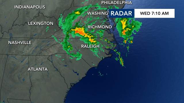
Rain showers, which could be heavy at times, are likely across central North Carolina on Wednesday, but counties northeast of the Triangle are most at risk for flooding. Franklin, Nash, Vance and Warren counties were under a flash flood warning until 8:45 a.m.
Track rain with the DualDoppler5000.
Water rescues were underway in Nash County, and trees were down in Franklin County.
Those counties will see the most rain on Wednesday, but southern counties could see some sunshine as the slow-moving low pressure system lifts to the north.
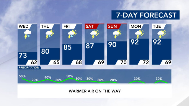
By Wednesday night and Thursday, everyone should notice a decrease in rain, and the system should move away by Friday. There is, however, some rain in the forecast through Sunday.
After two days of temperatures in the 60s, Wednesday will be warmer, with a high around 73 degrees in Raleigh. Thursday and Friday will feature highs in the low to mid 80s, which is typical for mid-June.
According to WRAL meteorologist Peta Sheerwood, the intensity of the rain will decrease throughout the week, and we should see some sunshine by Thursday.
The weekend should be mostly clear but hot, with highs in the upper 80s or lower 90s. There is a lesser chance for thunderstorms each day.

