- Teen thrown from home during EF-2 tornado takes first steps in ICU — with a surprise message from Shaq
- Tennessee restores 46 out of 49 roads post-Hurricane Helene
- Duke Energy boosts storm readiness with technology ahead of hurricane season
- Acting head of FEMA told staff he was previously unaware the US has a hurricane season; DHS said he was joking
- What Texas lawmakers did after the state’s largest wildfire
FORECAST: The 90's continue; Hanna now a Tropical Storm

CHARLOTTE, N.C. —
THE CHARLOTTE AREA:
The streak continues Sunday! It will make 17 days in a row of 90°+! Highs will climb into the low 90s with afternoon thunderstorms developing, especially in the High Country. Today storms will be a bit more isolated and less numerous than the last couple days but they will still be here! Any storms that develop will dissipate after sunset. Everyone will not see rain tomorrow, but those that do will deal with gusty winds and downpours. When you factor in the humidity, it will feel like it is 95-100 degrees today.
This work week: The 90s continue! Each day will have a chance for an isolated to scattered thunderstorm but a nearby front the middle of the week could inspire more widespread thunderstorms Wednesday-Friday. Also, while we aren’t expecting a big cool down by any means, highs look to drop to around 90 degrees by midweek.
Tropical Update:
Gonzalo has weakened and is now post-tropical. The National Hurricane Center will not issue any more advisories.
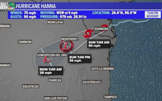
Hurricane Hanna has made landfall on Padre Island, Texas. It is the first hurricane of the 2020 Atlantic Hurricane Season. Hanna snagged another record for this season, being the earliest 8th named storm of any Atlantic Hurricane Season. Hanna will bring heavy rain across Southern Texas and parts of Mexico. Hanna will weaken as it remains over land.
INVEST 92 – L is off the African coast moving west. It is quite disorganized but we will likely see more organization early next week. There is a chance that before we end July (Friday)… we could have our next named storm. Next on the list Isaias.