- $40 million to go to underserved SC counties for Hurricane Helene recovery. Here's what you need to know.
- Family honors Air Force veteran Derwin Anderson Jr. after he died in June flash floods
- City of Wilmington addresses flooding on New Centre Drive
- Harnett County fire: Two homes damaged
- Medical examiner identifies 13th victim from massive flash flood in San Antonio
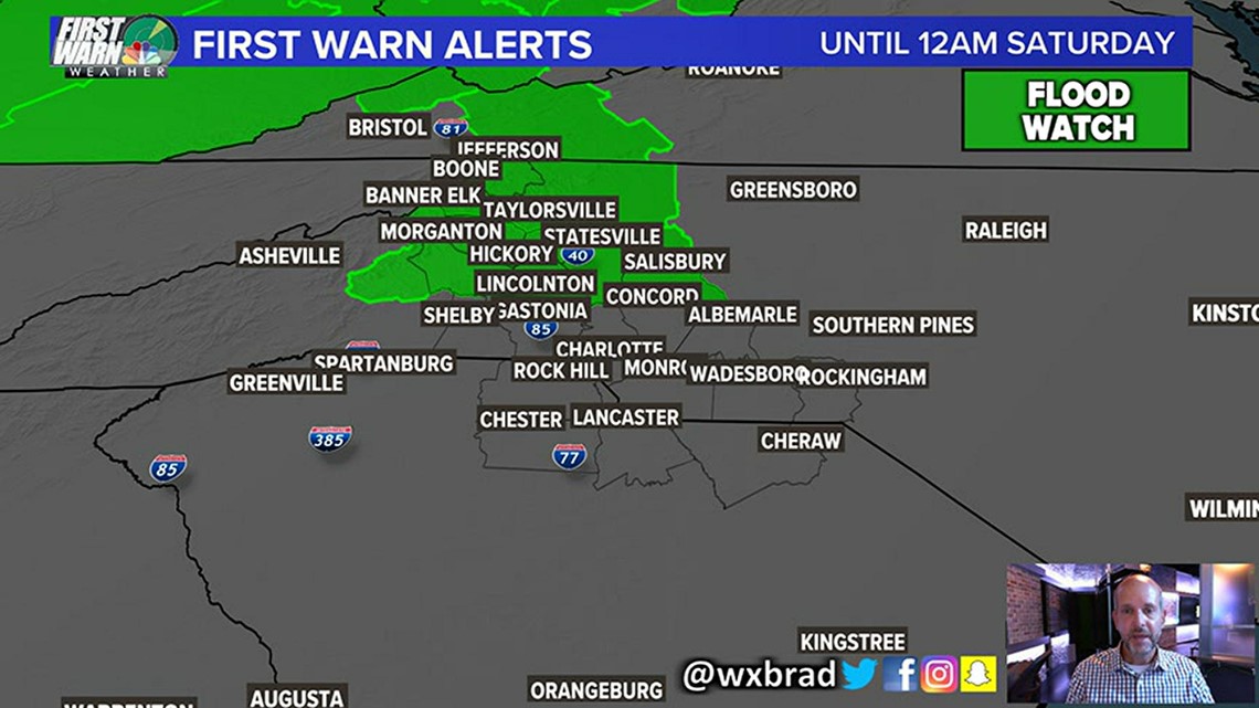
FORECAST: Flash Flooding a Dangerous Concern

CHARLOTTE, N.C. — Falling Creek And Snow Creek in Hickory are under a Flash Flood Emergency until 6:15AM. Flooding is subsiding but more heavy rain is on the way. The rest of the area near and in Catawba County is also under a Flash Flood Warning until the same time!
More rain is moving back into the area so more life-threatening Flash Flooding is possible this morning.
NWS BULLETIN:
At 326 Am Edt, Emergency Management Reported Thunderstorms Producing
Heavy Rain Across The Warned Area. Flash Flooding Is Ongoing With
Swift Water Rescues Occurring.
This Is A Flash Flood Emergency For Falling Creek And Snow Creek In
Hickory. This Is A Particularly Dangerous Situation. Seek Higher
Ground Now!
Saturday will be more of the same with scattered heavy downpours and some could be heavy and even strong at times. Highs will be in the mid to upper 80s. The chance of rain is near 70%.
Saturday will be a much better day with partly to mostly sunny skies and just isolated thunderstorms chances at 20-30% Highs will be back near 90.
TROPICAL UPDATE:
Tropical Storm Josephine is moving west-northwest at seventeen mph with a turn to the northwest this weekend. Winds are sustained at 45 mph, with some strengthening expected during the next two days. The current position of Josephine is around 700 miles from the Northern Leeward Islands.
An area of low pressure is about 100 miles from Cape Hatteras. It’s moving in the Atlantic east-northeast and could become a tropical or sub-tropical storm during the next few days. It won’t be a threat to the Carolinas and will move southeast of New England. The next name on the list is “Kyle”.