- Austin leaders consider expanding wildfire protection plan
- Large hail, strong winds and tornado threat possible into Thursday evening
- Large hail, tornado threat possible Thursday evening
- Jaccob Slavin scores in OT as the Hurricanes beat the Capitals in Game 1 of their 2nd-round series
- 5 On Your Side: What happened to cars flooded during Hurricane Helene?
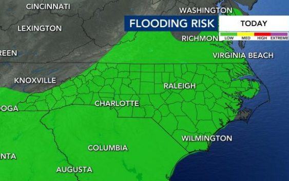
Pattern of rain and storms sets in for next three days, flooding possible
Raleigh, N.C. — Scattered showers and thunderstorms are possible Wednesday morning and throughout the afternoon.
WRAL meteorologist Elizabeth Gardner said our southern and southeastern counties could see rain or storms Wednesday morning, and storms will become more likely for everyone after lunch.
Pockets of heavy rain could lead to flash flooding in a few spots, and much of the area is under a low flood risk.
Highs will be in the mid 80s, but temperatures will feel more humid than they did Tuesday. On Wednesday, Thursday and Friday, there will be between a 50% and 60% chance for rain, and the air will be thick and humid.
On Thursday, showers and storms will be more widespread, and counties southeast of the Triangle will be under a Level 1 threat for severe weather.
Friday’s high will be in the low 80s, but storm chances continue.

The weekend could also be stormy, and temperatures will climb back into the upper 90s.
There is a strong chance that at least one tropical depression could form in the Atlantic in the next several days, though it’s too early to determine if the U.S. will be affected. Get the latest tropical update here.