- Carolina Hurricanes start 2025-26 season hosting New Jersey Devils
- Speedy Sparks, bassist for Texas Tornados, other San Antonio music icons, has died
- Authorities make an arrest related to deadly January wildfire that leveled LA neighborhood
- AI simulation gives Carolina Hurricanes 20% chance to win 2026 Stanley Cup
- Warf steps down as president of Carolina Hurricanes
Tropical Storm Eta makes makes second landfall in Florida

Eta landed near Cedar Key, Fla, around 4 a.m., bringing maximum sustained winds of 50 miles per hour. Eta is expected to weaken as it moves across Florida toward Jacksonville. It’s moving northeast at 13 miles per hour as of 4 a.m.
The storm should retain tropical storm strength through Thursday night. By Friday morning, Eta is expected to weaken and move east into the Atlantic Ocean.
Eta briefly regained hurricane strength Wednesday, but was later downgraded back to a tropical storm.
SEE ALSO: Subtropical Storm Theta becomes record-breaking 29th named storm in 2020 Atlantic season
There were no immediate reports of injuries or serious damage or flooding in the U.S.
The hurricane center said “life-threatening storm surge” is possible early Thursday, and forecasters advised residents to heed warnings from local officials. Tropical storm-force winds are expected in the area by late Wednesday.
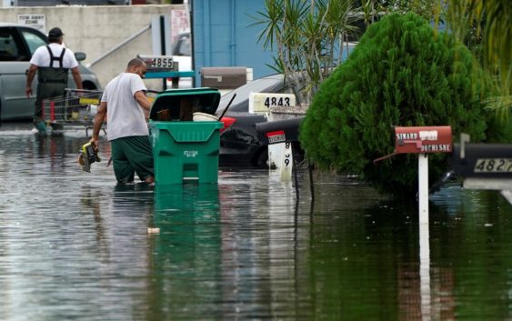
Forecasts call for more rain from the storm system over parts of already drenched South Florida.
“Never seen this, never, not this deep,” said Anthony Lyas, who has lived in his now-waterlogged Fort Lauderdale neighborhood since 1996. He described hearing water and debris slamming against his shuttered home overnight as the storm crossed Florida.
Storm Ready 2020: Preparing in a Pandemic
The storm first hit Nicaragua as a Category 4 hurricane and killed nearly 70 people from Mexico to Panama, before moving into the Gulf of Mexico early Monday near where the Everglades meet the sea, with maximum sustained winds of 50 mph (85 kph).
There was nowhere for the water to go across much of South Florida, which had already experienced nearly 14 inches (35 centimeters) of rain in October.
Eta hit land late Sunday as it blew over Lower Matecumbe, in the middle of the chain of small islands that form the Keys, but the heavily populated areas of Miami-Dade and Broward Counties bore the brunt of the fury.
It was the 28th named storm of a busy Atlantic hurricane season, tying the 2005 record for named storms. And late Monday, it was followed by the 29th storm – Theta.
The U.S. National Hurricane Center in Miami said Theta broke the record of 28 named storms in 2005. Theta was centered Wednesday morning about 740 miles (1,190 kilometers) southwest of the Azores, bearing top sustained winds of 65 mph (100 kph) as that system moved east-northeast at 8 mph (13 kph).
Copyright © 2020 ABC11-WTVD-TV/DT. All Rights Reserved – The Associated Press contributed to this report.