- Rock Hill storm damage costs are 'somewhere around $5 million.' That number doesn't include damage to personal property
- Rock Hill storm damage costs are 'somewhere around $5 million.' That number doesn't include damage to personal property
- ‘Somewhere around $5 million’ | Rock Hill officials see major storm damage costs
- The deadliest tornadoes to ever hit Austin
- Whiteville resident recalls events from Tuesday nights tornado
Wake Forest research could lead to better, sooner tornado warnings
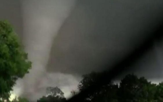
When a tornado threatens, an extra minute of warning could mean the difference between life and death.
Advances in Doppler radar technology have given meteorologists a better chance of detecting tornadoes and issuing timely warnings. These days, the National Weather Service is able to warn about 10 minutes before a tornado strikes, but research indicates those lead times have plateaued in recent years. Meteorologists are searching for new ways to detect dangerous storms and provide earlier warnings.
Ongoing research from a Wake Forest organization could play an important role in improving severe weather forecasts. The Wireless Research Center (WRC) is a non-profit laboratory that usually studies engineering issues facing the wireless industry, but its founder and president says the center also looks for ways to advance the public good.
“We tend to focus on the wireless technology,” said Dr. Gerry Hayes. “But that’s the foundation we build on.”
Engineers have been using that foundation to study an idea: Could radio waves be used to detect changes in atmospheric conditions? The National Oceanic and Atmospheric Administration (NOAA) provided a grant for WRC engineers to study the idea.
Using a couple of antennas and a humidifier, they found that measuring changes in radio waves emitted by 4G and 5G antennas could be used to derive changes in humidity. That’s important, because low-level humidity plays an important role in the formation of tornadoes.
Meteorologists and forecast models currently get humidity observations from a network of weather stations located primarily at airports. WRC senior engineer Dr. Mike Barts says measuring humidity between cell towers could provide much more data for forecasters.
“With the weather stations, you have a pixel here and a pixel there,” he said. “Now, we can look at a larger area with more pixels, if you will, so we get a better idea of what the humidity is doing.”
That extra data could help meteorologists build better forecasts. In the effort to increase warning lead times, NOAA’s National Severe Storms Laboratory has been developing a new system for predicting short-term thunderstorm hazards called the “Warn on Forecast System” (WoFS). The system includes use of rapidly-updated forecast models to predict threats from individual storms over the next six hours. Adding higher-resolution data about low-level humidity would make the models more accurate, giving forecasters an edge in predicting dangerous severe weather situations.
Barts says with cell towers already built throughout the country, this technology could be a fairly low-cost way to add an important new dimension to forecast models.
The WRC’s research is in the early stages. Currently, the group is trying to secure funding to continue the testing with a live cell tower. These engineers say putting the concept into practice will be a long journey, but they hope their work can save lives in the future.
“It’s what makes us engineers,” Hayes said. “’How do we fix it?’ or ‘How do we make it better?’ are the things we’re always asking.”