- Caddo Mounds State Historic Site to celebrate new visitor center, traditional grass house after 2019 tornado
- Flooding continues to wreak havoc on Southeast Texas homes
- Houston-area storm damage updates: NWS says two EF-1 tornadoes and powerful derecho event hit SE Texas
- Houston-area storm damage updates: NWS says two EF-1 tornadoes and powerful dericho event hit SE Texas
- NWS confirms two EF 1 tornados touched down Thursday -- one in the Cypress area and one in Waller County
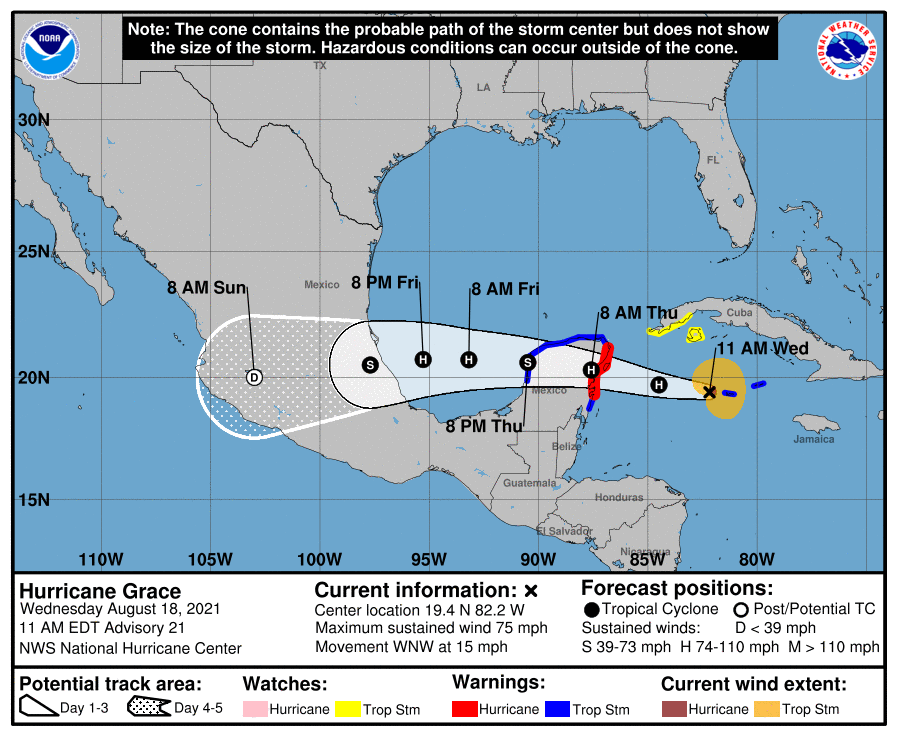
Tropical Storm Grace expected to become hurricane again: Track the storm, possible impacts

Tropical Storm Grace is expected to become a hurricane again soon as of Friday morning.
Grace has maximum sustained winds of 70 mph, according to an advisory issued at 4 a.m. from the National Hurricane Center.
The storm is forecast to strengthen over the next several hours as it moves across the southwestern Gulf of Mexico Friday. It is expected to make landfall along the coast of mainland Mexico this evening or tonight. After landfall, Grace should weaken rapidly as it moves into the mountains of central Mexico.
Tropical-storm-force winds extend 150 miles from center.
Grace is located 265 miles east of Tuxpan, Mexico, and is moving west at 16 mph.
Cone of uncertainty: See the latest graphic from the NHC
Satellite images: See latest satellite image from NOAA, for a clearer picture of the storm’s size
Latest data on Grace
Here is the latest data on Tropical Storm Grace pulled from the National Hurricane Center’s 4 a.m. advisory.
- Location: 265 miles east of Tuxpan, Mexico
- Maximum sustained winds: 70 mph
- Movement: west at 16 mph
- Pressure: 994 MB (millibars)
- When next advisory will be released: 7 a.m.