- How to protect your car before a hailstorm
- ‘We lost everything’: East Texas residents confront their future after flooding
- Here's how to get your flooding debris picked up by the City of Houston
- Mosquito activity on the rise due to rainfall, flooding across Texas
- Volunteers help Conroe community clean up in wake of flooding in Montgomery County
Nice Warm Weekend Before Severe Weather Returns To North Texas
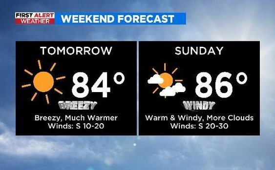
NORTH TEXAS (CBSDFW.COM) – Friday will be the coolest day of the weekend with highs only climbing into the upper 60s/low 70s during the afternoon.
The weekend forecast looks very nice overall. After today, southerly winds return to North Texas on Saturday and Sunday, resulting in a fast warmup by late weekend. This also means there will be bigger concerns where wind/fire danger is already an issue.
There is a slight chance for an isolated storm on Sunday but as of now, the cap looks to keep that severe weather at bay.
Starting Saturday, the Storm Prediction Center will begin issuing the expected threat level for Monday. As things stands, each afternoon/evening on Monday, Tuesday and Wednesday presents a severe weather threat.

Weather conditions are always fluid, but the current day-by-day breakdown is:
- Monday – Isolated strong to severe storms possible along and east of Interstate-35
- Tuesday -Widespread strong to severe storms expected for most of North Texas
- Wednesday – Scattered strong to severe storms possible east of I-35
Right now, forecasts show the possibility for damaging winds, large hail, and tornadoes during the severe weather events. But Tuesday has the greatest risk of severe weather areawide.
CBS 11 Meteorologists are monitoring and will have more updates through the weekend.