- Here's how to get your flooding debris picked up by the City of Houston
- Mosquito activity on the rise due to rainfall, flooding across Texas
- Volunteers help Conroe community clean up in wake of flooding in Montgomery County
- Why leaders are urging NC residents to start hurricane prep now
- Storms could produce hail, damaging winds south of Charlotte
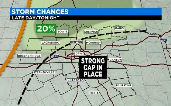
Slight risk for severe weather in North Texas later today
NORTH TEXAS (CBSDFW.COM) – Expect Friday’s weather to be warm, humid and windy. Morning clouds will break giving way to a partly cloudy afternoon. Hang onto your hats, because winds gusts will be up to 35mph.
There is a chance for some severe weather today. If it happens it will be toward the end of the day in counties to the northwest and along the Red River. Large hail and damaging winds will be the main threats.
A strong cap is in place over most of North Texas. If any of these storms that form along the dryline move into Parker or Tarrant County later today, the cap will quickly diminish in strength.
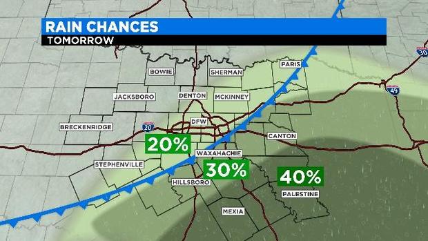
A cold front passes through North Texas on Saturday. It should get through the Metroplex around midday with much higher storm chances by afternoon across counties to the southeast.
The weather won’t be quite as windy on Saturday but highs will again climb into the mid 80s. The weekend has some storm chances each day, but don’t change your outdoor plans, the chances are small.
The cold front that moves over the Metroplex tomorrow stalls to our south and returns as a warm front on Sunday. Storms chances on Sunday are small — around 30% — but chances are widespread.
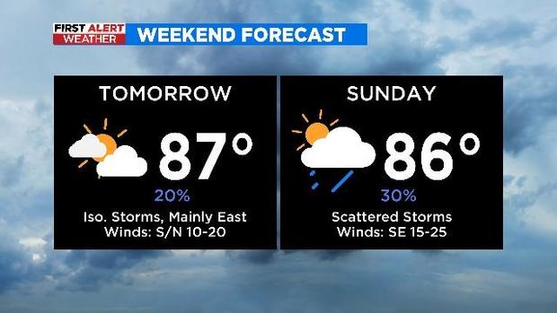
The best chance of storms this weekend will show up late on Sunday and go into Monday morning. It is too early to tell if these storms will be severe or not. But don’t worry, since it is a possibility the First Alert Weather Team will keep you posted.