- ‘We lost everything’: East Texas residents confront their future after flooding
- Here's how to get your flooding debris picked up by the City of Houston
- Mosquito activity on the rise due to rainfall, flooding across Texas
- Volunteers help Conroe community clean up in wake of flooding in Montgomery County
- Why leaders are urging NC residents to start hurricane prep now
Heavy rainfall, possible flooding stay on radar for San Antonio
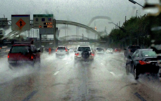
Isolated showers are anticipated throughout the day and could eventually lead to minor flooding
The NWS anticipates isolated showers throughout the day that could eventually lead to minor flooding in San Antonio
Bill Barfield/Getty ImagesThe tried old adage of being careful what you ask for seems to be ringing loud and clear in the Alamo City as the National Weather Service reports more heavy rainfall and potential flooding this afternoon and through at least the middle of the week. Several flash flood warnings have already been put in effect across portions of the Southern Edwards Plateau and the Rio Grande Plains from this morning’s rainfall, the weather service provider reported.
According to the agency, showers and thunderstorms will occur most likely after 2 p.m. today with mostly cloudy conditions and temperatures hitting the high 90s. The chance of precipitation is recorded at 70% with wind speeds suggested at around 5 mph. Rainfall amounts are expected to hit between a quarter and half of an inch.
Scattered storms and showers are expected through the late afternoon and through the night into Wednesday and again on Thursday as the National Weather Service expects even more scattered activity. Chances of precipitation is again set at 70% tomorrow as showers and thunderstorms will most likely occur before 8 p.m. Rainfall is expected between a half and three quarters of an inch, the NWS reports.
On Thursday, Sept.1, San Antonio and its surrounding areas will have a 50 percent chance of showers and thunderstorms. Conditions throughout the day will be partly sunny, with a high near 92 degrees. Calm winds will come from toward the northeast, early in the morning. Chances of precipitation throughout the remainder of the week is set as high as 60 percent.
As rainfall continues, the NWS has a few key messages to share with the general public:
- While rainfall will be beneficial for many, some rounds could produce heavy rainfall quickly for some locations, with rainfall rates of 2-4 inches per hour possible in heaviest activity.
- Despite ongoing long-term drought conditions, these types of rainfall rates could produce spots of quick flooding, especially in low water crossings and urban areas.
- Additional chances of showers and storms are forecast across South Central Texas at the end of this week into the weekend. Locations and timing are currently difficult to pinpoint exactly.
- A few storms could also produce strong wind gusts.