- WATCH: Video Shows Confirmed Tornado touches down in Columbus County
- Residents begin clean up after storms, apparent tornado roll through NC Tuesday
- Flooding lingers in Liberty County neighborhoods near Trinity River with more rainfall expected
- North Carolina behind on hurricane preparedness, study shows
- North Carolina way behind on hurricane preparedness, study shows
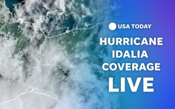
'Don't mess around with this': Historic Hurricane Idalia barrels toward Florida. Live updates
SPRING HILL, Fla. − Idalia grew to hurricane strength Tuesday, a treacherous tropical cyclone plowing past Cuba into the Gulf of Mexico and poised to intensify as it drives a potentially deadly storm surge toward the Big Bend area of Florida’s west coast.
The National Weather Service warned of a “life-threatening, dangerous situation,” saying the storm could make landfall as a major hurricane Wednesday − meaning winds in excess of 110 mph.
“To put this system into the historical context, there are no major hurricanes in the historical dataset going backto 1851 that have tracked into Apalachee Bay. None,” the advisory said. “Don’t mess around with this.”
Idalia, steering winds of 85 mph, was centered about 275 miles southwest of Tampa early afternoon Tuesday. A hurricane warning was issued along hundreds of miles of Florida coastline as the storm heads toward an apparent landfall along Florida’s Big Bend.
Gov. Ron DeSantis, at a briefing, said highway tolls were being waived, shelters were opening and hotels were prepared to take evacuees. More than 30,000 utility workers were preparing to repair outages when the storm passes.
DeSantis said landfall appeared to be headed toward Taylor County, southeast of Tallahassee and one of the most rural and economically challenged areas of the state. But he said it was too early to know exactly where the storm would hit.
“Everybody on the Gulf Coast from Tampa Bay to northwest Florida must be vigilant,” he said. “You’re going to see some nasty weather.”
At a self-serve sandbag site in Spring Hill, well within Hernando County’s mandatory evacuation zone, Jeff Manor and Judy Hodder were preparing bags to place along the doors and garage of their coastal home. They already brought in their outdoor furniture, towed their pontoon boat out of a nearby canal and tied it down on the side of their home.
“We’re staying here,” Hodder, 67, said as she wiped sweat from her forehead. “But if it starts coming at us, we’re gone.”

What is rapid intensification?How Idalia could quickly become a major hurricane before landfall
Developments:
∎ DeSantis said 5,000 National Guardsmen were activated, 580 search and rescue workers in eight teams were mobilized, 1,100 generators were prepped for deployment, and 200 ambulances were ready to sweep into the affected area when feasible. And 400,000 gallons of fuel was reserved for post-recovery.
∎ Idalia was heading north at 14 mph Tuesday and could gain power and speed as it curves to the north-northeast late Tuesday and Wednesday, reaching sustained wind speeds of up to 125 mph before landfall.
∎ The center of Idalia was forecast to move over the eastern Gulf of Mexico, carrying a storm surge of up to 15 feet closest to where it makes landfall, possibly along Florida’s Big Bend, on Wednesday morning.
∎ Idalia is forecast to remain a hurricane as it crosses into Georgia, before it moves over the Carolina coastline on Thursday, then out into the Atlantic where its future path remains uncertain.

Florida is on storm surge watch:Here’s what that means
Follow the path of Idalia as storm heads for Florida
This forecast track shows the most likely path of the center of the storm but does not illustrate the full width of the storm or its impacts, and the center of the storm is likely to travel outside the cone up to 33% of the time.
‘Gloom and doom… (or) everything is going to be fine’
Dozens of Hernando Beach and Weeki Wachee locals looking to fortify their homes on Tuesday took shovels to large sand mounds, packed bags full and lugged them to their cars and trucks within eyeshot of the Gulf of Mexico where several feet of storm surge is expected.
At a self-service sandbag site at Linda Pedersen Park in Spring Hill, Alan Covington, 63, and Vreli Covington, 63, hurriedly stuffed the truck bed of their Ford F-150 with sandbags. For the last seven years, they have lived in a single-story home within 100 yards of the Gulf.
“They’re for us but mostly for our neighbor, who has been in New Hampshire the last few days,” Alan Covington said, pointing to the bags. “I told him ‘We’re gonna put sandbags up for you’ … not that it’s gonna do any good.”
The couple took in all the furniture, packed their valuable papers and stored their boat at a nearby marina. Once they set up the sandbags, they are going to take refuge at a friend’s two-story, inland home.
“We’re going to push away with positivity,” Vreli Cunningham said. “We’re the two ends of the spectrum. Mister doom and gloom and me, miss ‘everything is going to be fine.'”
Idalia could thrive on warm waters of Gulf
Hurricane Idalia’s path toward Florida’s coast takes it through a steamy hot tub otherwise known as the Gulf of Mexico. That’s worrisome because hurricanes thrive on warm water. It fuels the heat and water vapor that make them stronger and capable of dumping more extreme rainfall. And unseasonably warm water temperatures have lingered in the Gulf for weeks, making it even hotter than normal.
In a worst-case scenario Tuesday, the tropical cyclone will be moving along the coast in water temperatures among the hottest on record in the Gulf as it spins toward a landfall overnight or Wednesday morning.
Evacuation urged ahead of potential wall of water
Catastrophic impacts from a storm surge of up to 15 feet above ground level topped by large, destructive waves are possible along a stretch of more than 100 miles of coastline from the Aucilla River to Yankeetown in the Big Bend region, the hurricane center said. A storm surge of three feet or more is possible, depending on the timing of high tides, to the north and the south from west of Apalachicola to Everglades City. Residents were urged to heed evacuation orders.
For context, the maximum water level measured after Hurricane Ian in Fort Myers Beach last fall was 15 feet. The hurricane center concluded in its post-Ian report that storm surge killed 41 people, more than any other single cause. The U.S. Geological Survey, university researchers and professional storm chasers were out placing specialty equipment along the coast Tuesday to measure the expected surge.The geological survey said Idalia’s surge could cause changes all along the state’s west coast, washing over sandy beaches and cutting into dunes.
Old nuclear power plant braces for Idalia
Approximately 85 miles north of Tampa along the Gulf of Mexico, the retired Crystal River Nuclear Plant sits near Idalia’s current forecasted path. Part of Duke Energy’s 5,100-acre complex that also includes active fossil fuel-powered plants in Citrus County, the old nuclear plant began decontamination and dismantling in 2020. In an email, federal Nuclear Regulatory Commission spokesperson Neil Sheehan said there is no operating reactor that would cause concern. Officials remain in contact with plant personnel who must complete pre-storm preparation, including ensuring radioactive materials are properly secured, he said.
Hurricane preparations for the site were completed Monday, Duke Energy spokesperson Mary Kathryn Green said in an email. Radioactive materials are permanently placed in shielded containers that withstand the effects of extreme weather, she added. Used nuclear fuel also remains securely sealed in on-site storage.
Keith Richardson, a spokesperson for Duke Energy, said the company was securing anything that could become airborne, storing equipment and ensuring generators are supplied should power be lost. Afterward, staff plan to conduct walkthroughs and inspections, he said.
“In terms of the process, that’s all accounted for,” Richardson said.
− Eduardo Cuevas
Big Bend is mostly rural, thinly populated
The Big Bend, the region where the Florida panhandle transitions into the peninsula, is tree-packed and rural. Taylor County, the southernmost county in the Big Bend, is home to only about 22,000 people, ranking it 54th in population out of the state’s 67 counties. To the western side, Franklin county ranks 64th, with a population of about 12,500. In 2021, about 19% of the residents in Franklin County lived below the poverty line, one of the poorest counties in the state.
Most of the population lives along the Apalachee Bay, a swampy swath of Florida where parts o the coastline remain undeveloped. Inland, three state forests connect the panhandle to the peninsula, and the tall pines that line the Big Bend Scenic Byway are very sensitive to wind damage and pose a threat to homes in high-speed winds.
− Ana Goni-Lessan, Tallahassee Democrat

Small wobble could drastically alter storm’s impact
Floridians are anxiously waiting to see if Idalia follows the forecast track, or makes any kind of last-minute wobble to the east that could bring worse-than-expected impacts from wind and water. Hurricane Ian last year and Hurricane Charley in 2004 curved toward a landfall a little earlier than expected. Any movement closer to land could increase the effects of storm surge, rain and higher winds closer to the center of the hurricane.
One neighborhood near Tampa Bay on Tuesday morning illustrated the gamut of emotions among residents on the west coast, but outside the forecast cone. One was putting up shutters, while another was laying sod. Kevin Guthrie, executive director of the Florida Division of Emergency Management, stressed that everyone should prepare for the worst.
“The storm is going to be here soon,” Guthrie said. “I implore you to finalize your disaster preparedness actions right now.”
Storm surge as high as 15 feet; evacuation orders in 22 counties
Idalia is forecast to make landfall overnight Tuesday or early Wednesday as a major hurricane with sustained winds near 120 mph. Storm surge − a sudden rise in water levels along beaches and into inland waterways − as high as 15 feet could slam the coast south of Florida’s Big Bend near the eventual point of landfall. Storm surge of at least 2-3 feet was possible along the state’s entire west coast, depending on how Idalia’s landfall coincides with full moon high tides. A storm surge of 4-7 feet could occur in Tampa Bay, the hurricane center warned.
Ryan Truchelut, chief meteorologist at Florida-based WeatherTiger, said Idalia will likely bring “catastrophic surge” to much of the west-central Florida and Big Bend coastline and a core of destructive winds to parts of North Florida. Idalia could become just the second Category 3 or higher hurricane − winds exceeding 110 mph − to make landfall there in the past 170 years, he said.
At least 22 of Florida’s 67 counties have evacuation orders in place and schools have closed in many counties as residents prepare for high winds and potential flash flooding.
What is storm surge?:Explaining a hurricane’s deadliest and most destructive threat
Evacuation orders:Hurricane Idalia rapidly intensifying; 22 Florida counties under evacuation orders
A foot of rain, tornadoes possible
Rainfall of 4-8 inches is forecast along portions of the state’s west coast and Panhandle, as well as along the path of the storm through Southeast Georgia and the eastern Carolinas, with isolated amounts up to 12 inches near where Idalia makes landfall, the National Weather Service said.
Tropical storm warnings were posted along all of Georgia’s coast and much of the Florida and South Carolina coasts. Cities such as Charlotte and Raleigh, North Carolina, are likely to observe a few inches of rain as Idalia moves along the Carolina coasts before gradually curving northeastward over the Atlantic Ocean, AccuWeather said.
“Tornadoes can also occur to the east of the center of the circulation as it moves across Florida,” AccuWeather Senior Meteorologist Dan Pydynowski said.
Weather Channel meteorologist Jim Cantore seen on Cedar Key
Sunday posts on X, the social platform formerly known as Twitter, that indicated The Weather Channel meteorologist Jim Cantore would show up in Florida were confirmed Monday. Cantore is long known for being in the middle of major storm events. An X user whose handle is Lt. Col. William Reid tweeted a photo from a Cedar Key restaurant, presumably Steamers: “Ran into the Jim Cantore while having dinner.”
Photos of the restaurant’s page on Facebook show a “dollar bill wall,” similar to the dollar bill wall in Reid’s tweet. Cantore has quite a history in Florida storms. You can read more here.
— Jennifer Sangalang, USA TODAY Network-Florida

Contributing: Jennifer Borresen