- North Carolina behind on hurricane preparedness, study shows
- North Carolina way behind on hurricane preparedness, study shows
- New hurricane preparedness report doesn't rank North Carolina well
- New hurricane preparedness report doesn't rank North Carolina well
- Southport hosts annual Hurricane Expo ahead of the 2024 season
Tornado Watch for Coastal Plains Sunday evening
Strong storms are reorganizing east of I-35 Sunday evening. Conditions forecast to settle overnight.
Grace Thornton, Shane Hinton (KVUE), Hunter Williams (KVUE)
2:58 PM CDT April 24, 2024
4:42 PM CDT April 28, 2024
AUSTIN, Texas — *A Tornado Watch has been issued until 9 p.m. CDT for Bastrop, Lee, Milam, Caldwell, and Fayette County.*
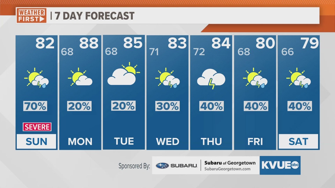
While parts of the state saw significant severe weather on Friday, here in Central Texas the weather stayed fairly uneventful. However, we’re not done with the storm chance for this weekend. We’re tracking another system that will bring a more widespread storm chance to our KVUE area late Saturday night into early Sunday morning. Some of these storms could be severe, especially across the Hill Country.
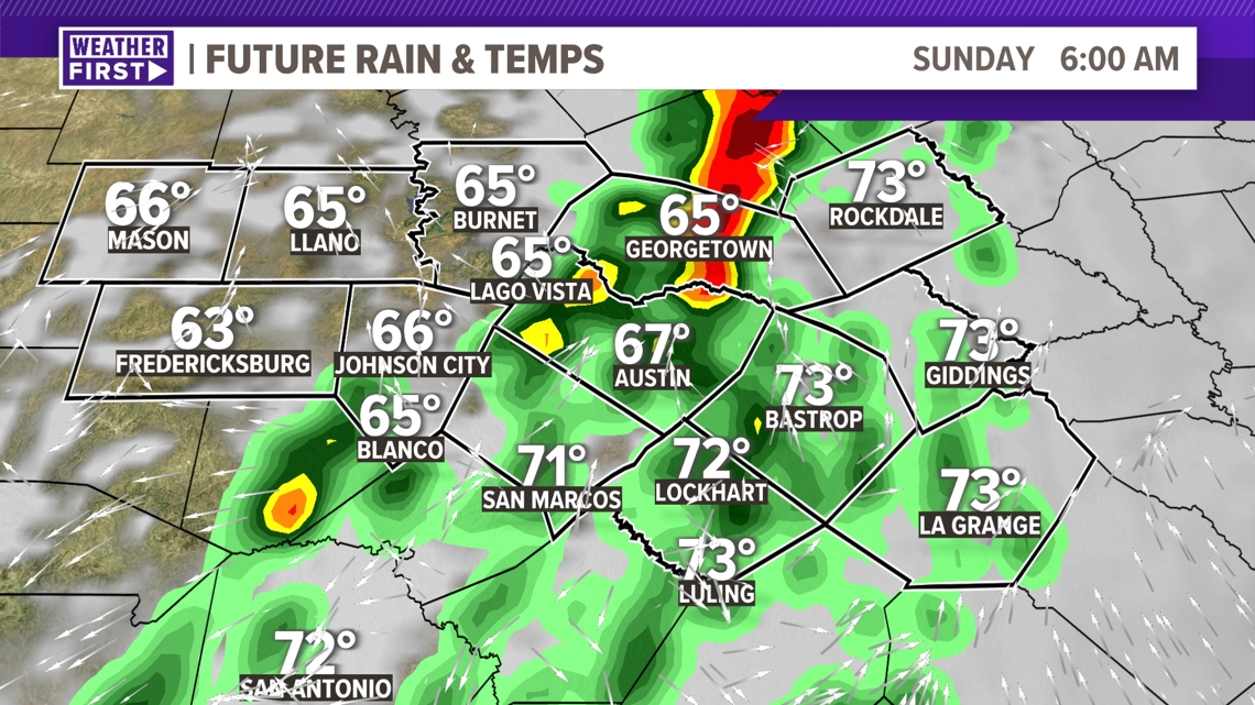
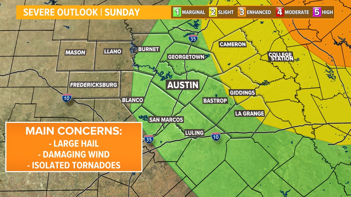
The storm chance for Sunday begins in the pre-dawn hours with storms moving into the western Hill Country after 2 a.m. The greatest severe risk will be west of Interstate 35, and we do expect these storms to be strong to severe upon arrival in the Hill Country.

However, the storms will likely be weakening on approach to Austin and the I-35 corridor. We can’t completely rule out severe weather in Austin, but the threat will be lower along and east of I-35. The weather then trends drier altogether for late morning into the afternoon.
The overall severe weather window will be 2 a.m. to 11 a.m. Sunday.

Our severe outlook continues into the rest of Sunday, with just a level one risk for the majority of our viewing area. Milam and Lee County stay in a level 2 risk. From 12 pm- 6 pm Sunday, it is possible for a few scattered and isolated showers or storms to develop again.

The weather pattern stays warm and unsettled through the workweek as rain and storm chances continue. The KVUE Weather Team will keep a close eye on this developing forecast.
In the meantime, the extended forecast can be found below.