- They couldn’t save their daughters’ lives in the July 4 floods. Now they’re dealing with the grief and the guilt.
- Austin could see heavy rains, possible flooding over the next few days
- Families of campers, counselors who died in Texas Hill County floods sue Camp Mystic
- Small plane bound for Jamaica with hurricane relief supplies crashes in Florida neighborhood
- Ask the Meteorologist: Did a tornado hit Johnston County Saturday night?
Watch Hurricane IQ: Weather Impact special
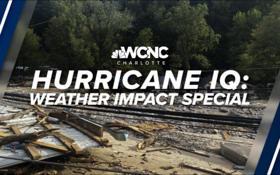
On Wednesday, June 4, at 8 p.m., you can stream the WCNC Weather Impact Team’s Hurricane IQ special on WCNC+.
CHARLOTTE, N.C. — June 1 is the start of hurricane season, so the WCNC Weather Impact Team wanted to take a look back at the 2024 Atlantic hurricane season and then forecast what the 2025 hurricane season might look like.
On Wednesday, June 4, at 8 p.m., you can stream the WCNC Weather Impact Team’s Hurricane IQ special on WCNC+ that dives into what is in store for the 2025 hurricane season. Download WCNC+ on your on Roku, Amazon Fire TV or Apple TV, and stream the Weather IQ hurricane special.
In 2024, the Atlantic basin saw 18 named storms in 2024, 11 of those were hurricanes and five intensified to major hurricanes. Five hurricanes made landfall in the U.S.
Last year was a record-setting season, too. Hurricane Beryl was the earliest Atlantic basin Category 5 hurricane on record. It caused significant storm surge flooding across parts of Texas and Louisiana after making landfall in Texas as a Category 1 storm.
Hurricane Helene made landfall as a Category 4 storm on the Florida Gulf Coast on Sept. 26. The next day, it caused catastrophic flooding across Western North Carolina. Helene was the deadliest hurricane to affect the continental U.S. since Hurricane Katrina in 2005. The majority of deaths were in North and South Carolina.
Less than two weeks later came Hurricane Milton, which made landfall as a Category 3 storm near Siesta Key, Florida, and resulted in a tornado outbreak that produced 46 tornadoes and caused torrential rainfall and localized flooding. Milton’s rate of rapid intensification was among the highest ever observed.
Watch the Hurricane IQ special on Wednesday, June 4, on WCNC+ to learn more about what’s in store for the 2025 hurricane season.
2025 hurricane season forecast
It’s the hurricane forecast for this season that we’re concerned about, and the things that we worry about first are the ENSO phase. What is that? Well, is it El Niño or La Niña or La Nada? Depending on what phase we’re in will dictate what type of season we have. The forecast is somewhere between La Niña and La Nada, which is the name for the neutral phase of that set up. That means temperatures here in the eastern Pacific are near normal or slight. If this trends towards La Niña, we expect above average amount of storms in the Atlantic.
Now, even in a neutral phase, the forecasts from all the major agencies, including North Carolina State, Colorado State and the National Hurricane Center, you can see are all above normal for named storms, hurricanes, as well as major hurricanes. Here’s a breakdown of what to expect from the 2025 hurricane season.
2025 hurricane names
Dexter has replaced Dorian, which was retired in 2019. Learn more about what the National Hurricane Center did to update its products and services for the 2025 Atlantic hurricane season.
Tropical terms
These are the terms you need to know this Atlantic Hurricane Season to understand the life cycle of a storm. Learn those terms here.
El Niño vs. La Niña vs. La Nada
The National Oceanic and Atmospheric Administration released its 2025 hurricane season outlook and, as expected, an above-average season is expected. Here’s how and La Nada impact our hurricane activity.
Impacts of a hurricane
While Charlotte is far enough inland that the Queen City doesn’t typically get the full force of a hurricane like those on the coast do, that doesn’t mean we’re safe from serious impacts. We often deal with the remnants of tropical storms and hurricanes. Think heavy rain, strong winds, flash flooding, and even tornadoes.
Hurricane Hugo in 1989 made landfall near Charleston as a Category 4, but even by the time it reached Charlotte, it was still a Category 1 hurricane. Winds peaked in Charlotte with a gust of 100 mph. Tropical Storm Fred in 2021 brought 12 confirmed tornadoes between North and South Carolina in one day, all of which were rated EF0 or EF1. And just last year, Hurricane Helene, though not a direct hit, dumped heavy rain and triggered landslides and flash flooding across western North Carolina. So here’s what you need to know, always have a way to receive weather alerts, especially overnight, make a plan in case of power outages or flooding and the weather alert and keep up to date with the forecast during hurricane season. And remember, just because we’re not on the coast doesn’t mean we’re not impacted.
Eyewall replacement cycle
You’ve probably heard of the eye of the hurricane before, but did you know the eye wall can be replaced? We break down the process here.
Steering currents
A misconception about hurricanes and tropical storms is that the winds in the storm move the storm across the ocean. However, a hurricane with 200 mph winds can barely move while a tropical storm with 40 mph winds can race across the Atlantic Ocean. The movement of tropical cyclones is controlled by steering currents, or steering winds. Learn more about why hurricanes go west when other weather travels east.
History of Category 5 hurricanes
Since 1924, the Atlantic Basin and Caribbean Sea have reached 42 hurricanes of Category 5 strength. We break down the history of Category 5 hurricanes in the Atlantic.
Weakening a hurricane
Tropical cyclones thrive in warm ocean waters due to the large amounts of moisture and heat the sea water can provide. As a storm encounters more warmth and more fuel, it’ll grow stronger and become more intense. On the other hand, here are the three factors can weaken a tropical cyclone.
Predecessor rain events
When it comes to the catastrophic flash flooding seen during Helene, several weather factors created a perfect storm. One of these was a predecessor rain event, or PRE, which is when heavy rain falls in advance of a tropical system. Raise your Weather IQ on how it influenced the impacts of devastating flooding from Helene.
Helene rebuilding
It’s been more than eight months since Hurricane Helene devastated western North Carolina. Helene made landfall in Florida in the Big Bend region as a Category 4 hurricane, but then the storm moved up the East Coast, decimating western North Carolina. The storm brought catastrophic inland flooding, extreme winds, landslides, and numerous tornadoes. The strongest wind gust in North Carolina was close to 106 mph up on Mount Mitchell. Some parts of the state saw 30 inches of rain, possibly as high as 40 inches from Helene. See how Chimney Rock is rebuilding after the devastating storm.
Flash flooding
Over the past decade, there have been over 1,000 flash floods in the Carolinas. Flooding is the second highest cause of weather-related deaths in the United States, which is why people will hear “turn around, don’t drown” often when severe weather hits. Here’s how little water it takes to knock a person down or sweep a vehicle away.
Climate change and Helene
There have been a lot of questions, comments and misinformation floating around about Hurricane Helene and the storm’s ties to climate change. We address those questions here.
NOAA cuts
During the hurricane season, communities rely on accurate forecasts to stay safe, but this year, meteorologists are facing an unexpected challenge budget cuts to NOAA and the National Weather Service. NOAA and the National Weather Service are responsible for tracking hurricanes, issuing warnings and collecting weather data. They’ve had a huge reduction in funding. The funding for this year was already cut 10%. For next year, the proposal is a 27% cut from the 2024 levels.
Now many local forecast offices are already working with reduced staffing levels, so they’re relying on remote help from other offices. A lot of these offices are already in hurricane prone areas. We’ve also seen a huge reduction in weather balloon launches due to staffing issues or lack of funding. Now key programs including storm research, forecast models, as well as aircraft reconnaissance missions like the hurricane hunters have all been scaled back.
Many have warned that this could make hurricane predictions less precise, leading to delayed evacuations and increasing risk to coastal residents. For instance, in previous seasons we’ve had unlimited resources to send multiple aircraft into storms to collect data in real time.
Fewer flights and reduced staffing, the ability to predict a storm’s path and intensity could be compromised in local communities like Charleston, Wilmington, and New Orleans, emergency managers are concerned without precise storm tracking, officials fear evacuation orders may be harder to issue. Timely, accurate forecasts save lives. If we don’t have reliable data from NOAA, it could put families at greater risks during the hurricane season.
Now experts are warning that the consequences of these budget cuts could be, you know, tremendous, so advocates are pushing that they get restored almost immediately. Now in the meantime, meteorologists and emergency officials urge residents, you got to stay informed, be prepared early, even with reduced staffing, the dedicated men and women in NOAA will work with the resources they have to make it really safe out there. It just makes it harder and more stressful in times of very active weather.
RELATED: In wake of deep cuts, NOAA says it will hire for ‘mission-critical’ weather service positions
Hurricane costs
Did you know inflation can also affect hurricane season? Here are the costliest storms in today’s dollars.
Hurricane hunters: NOAA vs. Air Force
As you know, hurricanes are one of the most destructive forces in nature, but thanks to dedicated teams flying straight into the eye of the storm, we get life-saving data. We look at two groups taking on that challenge the NOAA hurricane hunters and the Air Force hurricane hunters. They fly into chaos, braving turbulence and pounding winds, all for safety and science. The NOAA hurricane hunters and the Air Force’s 53rd weather reconnaissance squadron share the exact same goal, tracking storms before they make landfall, but their missions are slightly different. NOAA’s hurricane hunters focus on research.
NOAA has two Lockheed WP 3D Orion 4 engine turboprop aircraft. Now they’re affectionately. Nicknamed Kermit and Miss Piggy, they probe every wind pressure change, repeating this very often for a grueling schedule again and again during the course of an 8-10 hour mission. Their WP-3D Orion aircraft carries cutting edge instruments gathering scientific data to help improve storm predictions.
NOAA’s Gulfstream aircraft, which can fly high, fast and far with a range of 4000 nautical miles, and at a Cruising altitude of around 45,000 ft. It paints a detailed picture of the weather systems in the upper atmosphere around developing hurricanes. This helps in forecasting the steering currents so we can figure out where these storms are gonna go.
Meanwhile, the Air Force hurricane hunters, they fly WC-130J aircraft straight into the storm, collecting real-time data for immediate forecasting, positioning, and disaster response. The data these teams provides helps emergency responders make critical decisions. Without them, forecasting would be far less accurate. But challenges remain. NOAA’s fleet faces budget concerns while the Air Force squadron juggles military readiness.
Storm tracking and despite those obstacles, both teams continue their high stake mission, ensuring that the public is informed and prepared. Taking a look at the stats from last year, the NOAA hurricane hunters flew 392 mission hours to collect atmospheric data. The hurricane hunters passed through the eye of a hurricane 80 times. The Air Force’s hurricane hunter squadron, they flew 107 missions and 1130 hours into 14 storms.
100-year vs. 1000-year flood events
Last season, hurricanes Helene and Milton dumped unprecedented amounts of rain, which some experts call a once in a 1,000-year rain event. But some claim this should be considered a 1,000-year flooding event. We walk through the difference and what that even means.
Dirty side of a hurricane
Hurricanes can devastate coastal areas with epic winds, dangerous storm surges and even spawn multiple tornadoes. But one side of the storm is far worse than any other. It’s called the “dirty” part of the storm. Here’s what that means.
Power of hurricanes
The Aerodyn Wind Tunnel tests the aerodynamics of racecars but this week, we put one of our meteorologists in the tunnel to show the power of a major hurricane. See what happened when he stood in the wind tunnel.