- They couldn’t save their daughters’ lives in the July 4 floods. Now they’re dealing with the grief and the guilt.
- Austin could see heavy rains, possible flooding over the next few days
- Families of campers, counselors who died in Texas Hill County floods sue Camp Mystic
- Small plane bound for Jamaica with hurricane relief supplies crashes in Florida neighborhood
- Ask the Meteorologist: Did a tornado hit Johnston County Saturday night?
Here's how to find your hurricane evacuation zone and route
HOUSTON – Saturday marks the official start of hurricane season.
The National Oceanic and Atmospheric Administration predicted nine to 15 storms will develop in the Atlantic basin this year. Two to four storms could develop into major hurricanes, meaning winds of at least 110 mph.
“We can’t predict everything, so we can’t ever be 100 percent prepared, but we have to be prepared for the issues that we do know,” said Harris County Judge Lina Hidalgo.
Hidalgo urged residents to make an emergency plan.
“You (need to) know what to do with your family, your children, your pets in the event of an emergency,” Hidalgo said.
Hidalgo said families should also have a hurricane kit with medicine, food and water that will last at least seven days.
The judge said first responders are ready to serve and are better equipped this year.
“We have twice as many water rescue vehicles (and) boats as before Harvey,” Hidalgo said.
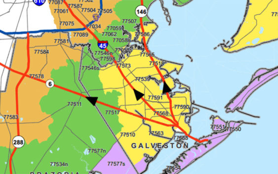
Harris County officials also released maps of the approved evacuation zones and routes that will be used for the 2019 season.
DOCUMENTS: Evacuation zones map | Evacuation routes map
There are even more resources available in the Hurricane Headquarters section at Click2Houston.com/hurricane.
Copyright 2019 by KPRC Click2Houston – All rights reserved.