- They couldn’t save their daughters’ lives in the July 4 floods. Now they’re dealing with the grief and the guilt.
- Austin could see heavy rains, possible flooding over the next few days
- Families of campers, counselors who died in Texas Hill County floods sue Camp Mystic
- Small plane bound for Jamaica with hurricane relief supplies crashes in Florida neighborhood
- Ask the Meteorologist: Did a tornado hit Johnston County Saturday night?
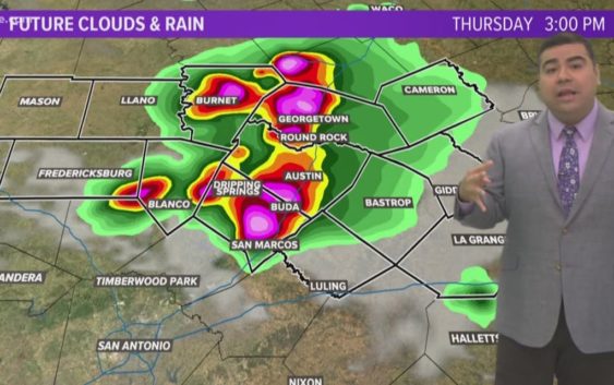
FORECAST: Severe weather threat returns for Thursday
AUSTIN, Texas — Weather Outlook
An Enhanced Risk for severe weather exists for Thursday with main threats being gusty winds upwards of 60 mph, large hail, and isolated tornadoes. Partly sunny skies will adorn the day with temperatures reaching into the mid to low 90s with uncomfortable humidity. Dangerous heat exists this weekend with surface temperatures in the upper 90s and heat index values at or above 105 degrees.
RELATED: Storm chance overnight; more storms Thursday afternoon
DETAILED FORECAST:
THURSDAY:
A 60% chance of showers and strong to severe thunderstorms in the afternoon. North-northwest winds 10 to 15 mph.
HIGH: 93°
TONIGHT:
Mostly cloudy skies becoming partly cloudy overnight. South wind at 5 mph.
LOW: 72°
FRIDAY:
Partly sunny skies under hot and humid conditions. Heat index values will near 100°. West-northwest wind 5 to 10 mph.
HIGH: 96°
RELATED: Allergy Report
Stay with KVUE on social media and download the KVUE News app so you can stay ahead of the storm. kvue.com/app