- Town of Wrightsville Beach preparing for coastal flooding this weekend
- Man charged with sparking the most destructive wildfire in Los Angeles history
- Carolina Hurricanes start 2025-26 season hosting New Jersey Devils
- Speedy Sparks, bassist for Texas Tornados, other San Antonio music icons, has died
- Authorities make an arrest related to deadly January wildfire that leveled LA neighborhood
Storms could bring damaging winds, small hail to Raleigh on Thursday night
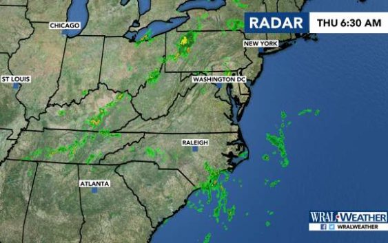
Raleigh, N.C. — The Triangle and northern areas of the state are under a level 1 risk for severe weather Thursday night.
The threat, which means isolated storms are possible, comes with a risk for damaging winds, heavy rain and small hail, WRAL meteorologist Elizabeth Gardner said.
A line of storms moving from the west is expected to hit Greensboro around 6:30 p.m. and move into the Triangle between 8 and 10 p.m.
On Friday, most of the state will be under a level 1 risk for severe weather. More damaging winds and heavy rain as well as frequent lightning are possible.
Thursday’s high will be 91, but the heat index will feel like the upper 90s.

The humidity will feel oppressive, Gardner said.
Friday’s high is 90 degrees, and temperatures climb to 94 over the weekend.
