- Families of campers, counselors who died in Texas Hill County floods sue Camp Mystic
- Small plane bound for Jamaica with hurricane relief supplies crashes in Florida neighborhood
- Ask the Meteorologist: Did a tornado hit Johnston County Saturday night?
- Demolition begins on flood-damaged homes in Stoney Creek as neighbors await relief
- NC Office of State Fire Marshal aiding in Hurricane Melissa relief efforts
Severe storms expected Thursday, hail and damaging winds possible
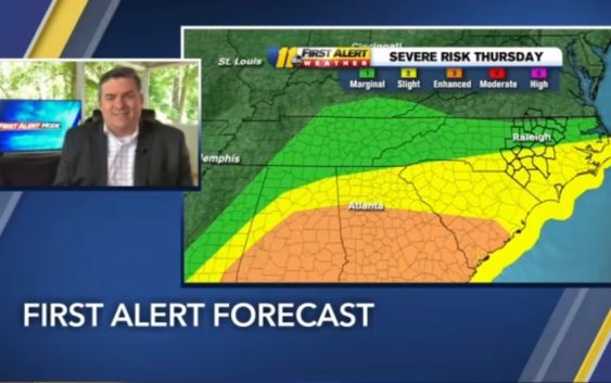
RALEIGH (WTVD) — The weather center in April is a very busy place, every year. It’s our busiest month for severe weather and we again have a threat in the Raleigh area for Thursday.
Severe risk for almost the entire viewing area on Thursday. Biggest threats=damaging wind and hail possible too! #ncwx pic.twitter.com/PsaFIfcn2C
— 𝘿𝙤𝙣 𝙎𝙘𝙝𝙬𝙚𝙣𝙣𝙚𝙠𝙚𝙧 (@BigweatherABC11) April 22, 2020
At the moment, the biggest threat is Thursday afternoon, especially in the southern part of our region.
The biggest threat is from damaging winds and/or hail. An isolated tornado could spin up too.
We will see some rain early in the day, which Big Weather says is a good thing. Any rain and cloud cover will hold down the energy in the atmosphere and may limit the amount of severe weather we see.
Just be weather aware as we head into Thursday. And if you haven’t done with the past storms, make sure and secure outdoor objects like patio furniture or a trampoline. It will definitely NOT be the day to leave the garbage cans out on the curb. Or they could end up in a very different place if the winds kick in.
Copyright © 2020 WTVD-TV. All Rights Reserved.