- Families of campers, counselors who died in Texas Hill County floods sue Camp Mystic
- Small plane bound for Jamaica with hurricane relief supplies crashes in Florida neighborhood
- Ask the Meteorologist: Did a tornado hit Johnston County Saturday night?
- Demolition begins on flood-damaged homes in Stoney Creek as neighbors await relief
- NC Office of State Fire Marshal aiding in Hurricane Melissa relief efforts
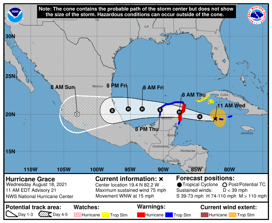
Tropical Storm Grace passes over Yucatan Peninsula: Track the storm, possible impacts

Grace was downgraded to a tropical storm Thursday morning as it passes over the Yucatan Peninsula, but it is expected to intensify later this weekend.
Grace has maximum sustained winds of 65 mph, making it a Category 1 storm, according to an advisory issued at 10 a.m. from the National Hurricane Center.
The storm is has weakened as it passes over the Yucatan Peninsula, but it is expected to strengthen again when it moves into the southwestern Gulf of Mexico. Grace is forecast to make landfall as a hurricane late Friday in Mexico.
Tropical-storm-force winds extend outward up to 140 miles from the center.
Grace is located 110 miles east of Campeche, Mexico, and is moving west at 18 mph. It is forecast to continue a west to northwest movement through Friday, where it will turn slightly to a west-southwestward motion.
Cone of uncertainty: See the latest graphic from the NHC
Satellite images: See latest satellite image from NOAA, for a clearer picture of the storm’s size
Latest data on Grace
Here is the latest data on Tropical Storm Grace pulled from the National Hurricane Center’s 10 a.m. advisory.
- Location: 110 miles east of Campeche, Mexico
- Maximum sustained winds: 65 mph
- Movement: west at 18 mph
- Pressure: 994 MB (millibars)
- When next advisory will be released: 1 p.m. CT