- Home to North Carolina iconic attraction reopens after Hurricane Helene’s devastation
- The government cuts key data used in hurricane forecasting, and experts sound an alarm
- Hurricanes leaders will make draft picks from NC HQ
- Tropical update: National Hurricane Center monitoring spot that could develop in southern Gulf
- Heavy rains Thursday afternoon cause street flooding across Houston, stranding vehicles
Parts of San Antonio under flood watch ahead of powerful arctic cold front
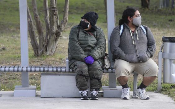
Michael Rivera (right) and his mother, Cathy, each show their own way of dealing with the morning chill while waiting for a VIA bus on Thursday, Jan. 20, 2022. Temperatures were in the 30s for most of the day.
Kin Man Hui, San Antonio Express-News / Staff photographerThough San Antonio enjoyed a sunny weekend, a powerful, arctic cold front is still on its way to San Antonio and South Central Texas, according to the National Weather Service. The system is slated to blow through on Wednesday evening.
San Antonio is expected to experience a mix of weather in the days leading up to the freeze. On Monday there is an 80 percent chance of rain with temperatures reaching 65 degrees. A flood watch is in effect for eastern areas of Bexar County through 9 p.m. on Monday. Tuesday is anticipated to be mostly sunny with high temperatures in the low 70s.
The National Weather Service stressed the weather event will “not be a repeat in severity and impacts” in comparison to February 2021’s deadly freeze. However, a hard freeze dipping into the low 20s with lower wind chill is anticipated Thursday through Saturday of this week in San Antonio.
This cold front is expected to bring the coldest temperatures of this winter that the impact area has experienced thus far.
Be Ready: February’s winter storm caught Texans by surprise. Here’s how to prepare this year.

An arctic blast is expected over Central Texas on Wednesday, February 2, 2022.
National Weather ServiceFor some areas along the I-35 corridor, particularly in the Texas Hill Country, this could mean temperatures dipping into the teens and a wintry mix of precipitation, like freezing rain and sleet, on Thursday morning.
At this time, confidence is growing that there could be icing roads across the Hill Country and even extending into Austin.
Read more from Camille