- U.S.-based aid groups rush to get supplies into storm-battered Jamaica after Hurricane Melissa
- Travelers stuck in Jamaica due to Hurricane Mellissa forced to pay for unwanted extended stay
- Raleigh police officer awaits word from family in Jamaica after Hurricane Melissa devastation
- North Carolina’s leaders give insight on the effects of Hurricane Melissa
- ‘We want some answers;’ Whiteville residents demand city response to prevent flooding
See how Florence's storm surge could affect where you live
Posted on by WeatherPreppers
Related Post
- U.S.-based aid groups rush to get supplies into storm-battered Jamaica after Hurricane Melissa
- Travelers stuck in Jamaica due to Hurricane Mellissa forced to pay for unwanted extended stay
- Raleigh police officer awaits word from family in Jamaica after Hurricane Melissa devastation
- North Carolina’s leaders give insight on the effects of Hurricane Melissa
- ‘We want some answers;’ Whiteville residents demand city response to prevent flooding
(Source: Pixabay)
SOUTHEASTERN NORTH CAROLINA (WECT) –
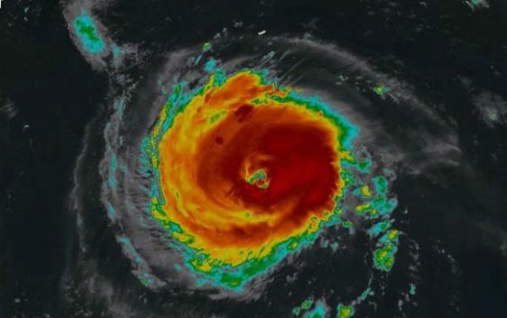
With Hurricane Florence bearing down on southeastern North Carolina, the storm is expected to bring a violent storm surge to the region.
The National Oceanic and Atmospheric Administration has put together an interactive online map that can show potential storm surge flooding where you live.
Forecasters believe the storm surge could reach in excess of 10 feet, especially as its eyewall jams close to the New Hanover County and Pender County barrier islands Thursday into Friday.
As the center of Florence wobbles westward toward Long Bay and the Grand Strand, storm surge in excess of 5 feet and possibly in more than 10 feet remains possible for the Brunswick County islands Friday into Saturday.
Copyright 2018 WECT. All rights reserved.