- Here's how to get your flooding debris picked up by the City of Houston
- Mosquito activity on the rise due to rainfall, flooding across Texas
- Volunteers help Conroe community clean up in wake of flooding in Montgomery County
- Why leaders are urging NC residents to start hurricane prep now
- Storms could produce hail, damaging winds south of Charlotte
NWS warns of renewed flooding risk ahead of mid-week storms
-
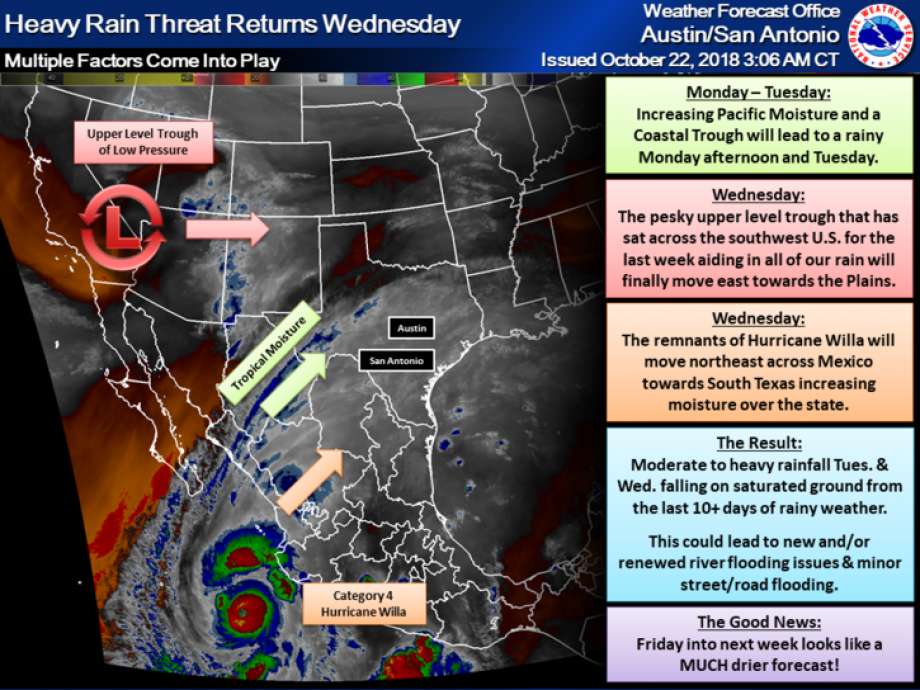
The National Weather Service is warning residents in South Central Texas of the possibility of renewed flooding this week as the remnants of a Pacific hurricane move through Mexico into Texas.
The National Weather Service is warning residents in South Central Texas of the possibility of renewed flooding this week as the remnants of a Pacific hurricane move through Mexico into Texas.
Photo: National Weather Service
The National Weather Service is warning residents in South Central Texas of the possibility of renewed flooding this week as the remnants of a Pacific hurricane move through Mexico into Texas.
The National Weather Service is warning residents in South Central Texas of the possibility of renewed flooding this week as the remnants of a Pacific hurricane move through Mexico into Texas.
Photo: National Weather Service
The National Weather Service is warning residents in South Central Texas of the possibility of renewed flooding this week as the remnants of a Pacific hurricane move through Mexico into Texas.
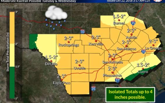
An additional 2 to 3 inches of rainfall is expected to affect the area, including San Antonio, through Wednesday, with isolated totals of up to 4 inches. Chances for rain begin Monday night but it is most likely to occur Tuesday and Wednesday.
That may not sound like a lot of moisture, but with the ground already saturated from more than 10 days of wet weather, the extra few inches may cause additional flooding.
RELATED: Hurricane off Mexico on track for South Texas
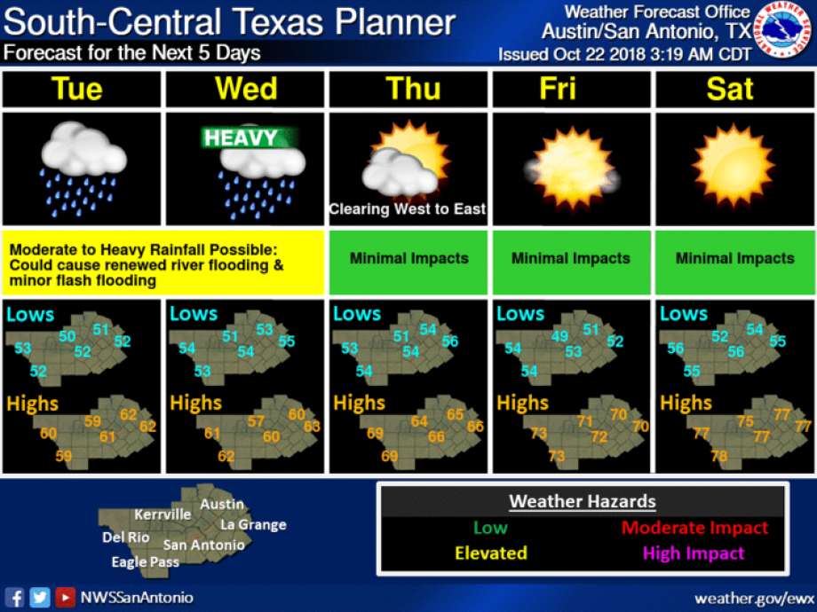
“The best chances for moderate to heavy rainfall look to be on Wednesday,” reads a forecast from the NWS. “With how saturated the ground is even just a few inches of rainfall could lead to new and/or renewed river flooding and some minor street/road flooding.”
Flooding could affect all of South Central Texas, but the Colorado, Llano, Nueces, Frio and Rio Grande river basins are most at risk, meteorologists said.
The rain will be generated by a region of low atmospheric pressure, which has been sitting in the southwestern area of the U.S. for the past week, in combination with the remnants of Hurricane Willa, which will move into South Texas on Wednesday.
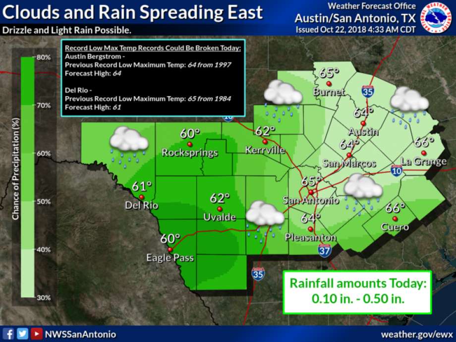
Temperatures are expected to be in the 50s and 60s Monday through Thursday.
The good news, according to the National Weather Service, is that South Central Texas could see some relief from the rain beginning Thursday. Friday and Saturday should be dry with highs in the 70s.
Text “NEWS” to 77453 for breaking news alerts from mySA.com
Caleb Downs covers crime in San Antonio and Bexar County. Read him on our breaking news site, mySA.com, and on our subscriber site, ExpressNews.com |
cdowns@mysa.com | @calebjdowns