- Flooding lingers in Liberty County neighborhoods near Trinity River with more rainfall expected
- North Carolina behind on hurricane preparedness, study shows
- North Carolina way behind on hurricane preparedness, study shows
- New hurricane preparedness report doesn't rank North Carolina well
- New hurricane preparedness report doesn't rank North Carolina well
Matthew, Florence Set Back-To-Back Flooding Records Across The Carolinas

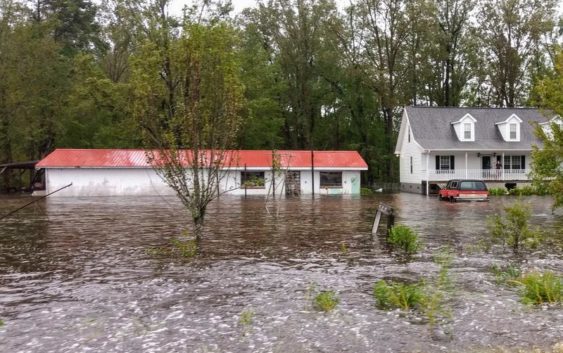
A new report released Tuesday showed rainfall from Hurricane Florence resulted in record flooding across the Carolinas, upending records set by Hurricane Matthew just two years prior.
The data was compiled by the U.S. Geological Survey, and was taken by streamgages — tools that record streamflows, or the volume of water moving past a fixed point — placed in rivers across the two states. The streamgages showed that 18 rivers in North Carolina and 10 in South Carolina had record-setting water levels during Florence.
According to the report, some sites with more than 70 years of data saw historic levels from the storm, which hit the coast at Wrightsville Beach, Sept. 14 as a Category 1 hurricane and then slowly moved inland.
The Waccamaw River in Freeland set a record Sept. 19 with water levels reaching over 22 feet — the river’s largest peak in its recorded history, which has data going back to 1940. In South Carolina, the Little Pee Dee River in Galivants Ferry also set a new record Sept. 21. It saw water levels reach over 17 feet, the highest recorded in 77 years.
According to the lead author of the study, Toby Feaster, Matthew also set records in flooding. Feaster said it’s notable that two record-setting events happened so close to each other.
“Since several of the streamgage sites we analyzed had more than 30 years of historical data associated with them, it was interesting that a majority of the number one and two records were from back-to-back flooding events,” Feaster said in a statement.
The information from the report is more than just data, USGS said. The report can be used by officials, emergency managers and engineers to prepare for future storms and mitigate flooding.