- Whiteville resident recalls events from Tuesday nights tornado
- Tornado damage reported in southern NC after Tuesday's severe storms
- If your home floods, here are steps you can take to address mold
- WATCH: Video Shows Confirmed Tornado touches down in Columbus County
- Residents begin clean up after storms, apparent tornado roll through NC Tuesday
Here's What You Need To Know About Hurricane Season In San Antonio
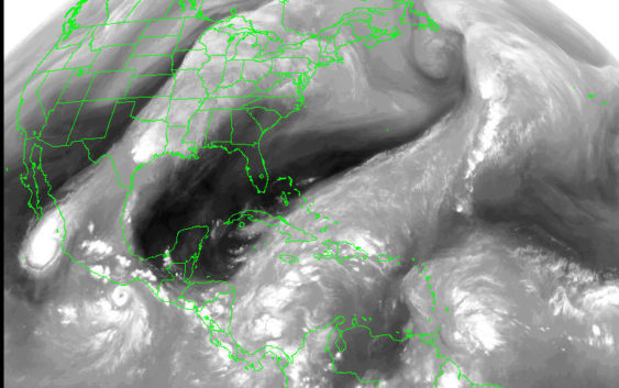
The National Weather Service reports Hurricane season officially begins June 1.
Forecasters said it will be an average Atlantic season will include nine to 15 named storms, including four to eight hurricanes and two to four major hurricanes.
NWS forecaster Brett Williams says an average season is forecasted because the wind shears created by El Niño are expected to cut through and destroy a number of tropical storms generated in the warm waters of the Gulf of Mexico.
Williams said the biggest threats to South Texas are heavy rains and flash flooding, especially if a Category 4 or 5 storm strikes the coast.
He said sustained winds up to 70 mph are possible for deep into South Texas is a Category 4 or 5 hurricane were to hit the middle coast, like around Corpus Christi.
“Tropical storm-force winds on a big storm like that is not out of the question, especially for our southeastern counties,” Williams said.
The first three storm names will be Andrea, Barry and Chantal.
The season ends on November 30, and South Texas tends to see the worst tropical weather in August and September.
The deadliest and costliest storm to have originated in the tropics and arrive on San Antonio’s doorstep was in 1921.
NWS reports the remnants of a tropical storm that year caused flooding that damaged downtown, killed 51-residents of San Antonio and left behind $5 million damage and adjusted for inflation remains the most expensive.
While the storm is nearly a century old, it left behind some very visible landmarks to prevent the future flooding of downtown San Antonio.
The 1921 flood as a historical note spurred the construction of the Olmos Dam and the bypass channel through downtown San Antonio that would later become the River Walk.
Forecasters said in October 1998 two Pacific hurricanes, not Atlantic ones, caused deadly flooding. Madeline and Lester pushed heavy rains over the area that resulted in flooding that caused 11 deaths in Bexar County and $750 million in damage.
San Antonio, like Austin, is pressed up against the Hill Country, in what is known as flash flood alley and where flooded low water crossings claim the most lives when motorists drive through them.
The weather service reports half of the flash flood fatalities in the state of Texas occur in the I-35 corridor from San Antonio to Austin and into to the Hill Country and many of those fatalities have occurred with tropical systems.
Nefi Garza, in charge of managing storm waters for the city’s Transportation and Capital Improvements Department, said there are 146 low water crossings in Bexar County, which are monitored in a high tech and joint way with the county.
“We have a computer system that we receive notification when water begins flowing and water begins rising, and it even tells us the moment when water goes over the road.”
Bexar County residents can monitor all the low water crossings at bexarflood.org., where you can select the most dangerous low water crossing near you to receive customized updates.
“You can actually click on one of those low water crossings and if you are interested you can actually subscribe to receive a test message or email when that low water crossing is flooding”
Garza said the city relies on crews to place barricades to keep motorists out of flooded low water crossing.
He said the city has tried a couple of automated systems, where flashing lights come on and arm poles drop over a flooded road after a monitor detects rising water, but they have proven to be a target for thieves.
“For some reason people like stealing the lights off of them or stealing the actual poles so we’re are constantly repairing those and so we have gone away from that and we are actually phasing those out,” he said.
The Texas Department of Public Safety, just like NWS, reports most of the people killed in flooding are motorists who drive into flood water.
Sergeant Orlando Moreno of the local DPS office says it only takes a foot of water to sweep a 3,000-pound vehicle off a flooded road and you can’t always trust the flood gauge on the side of the road to judge how deep the water is.
“When water is covering the road, you can’t see what is underneath that, so sometimes the road may be washed out below the water line and people feel like the water does not look very high and once they enter it, there is no road there and the car can become stuck and then as the water rises it gets carried off.”
Moreno said stay off the road when storms hit the city and make sure you are stocked up on a few days supply of water and food in case the power is knocked out by flooding and high winds. He said have an evacuation plan and be familiar with evacuation routes in advance in case you are asked to get out by a government agency. He says the disabled and elderly probably have special needs during evacuations, so have those ready in advance too. Many people also forgot to plan for these when Harvey hit last summer.
“A lot of pets were left behind by necessity and so its important to keep them in mind when you are evacuating also.”
Moreno also said if you live in a flood prone area make sure you buy flood insurance well in advance of potential flooding.
“There are a lot of times these flood policies have a 30 day waiting period before they even take effect,” he said.