- EF-1 tornadoes ripped through Cypress, Waller County areas with winds at more than 100 mph, NWS reports
- Houston-area storm damage updates: Clean up continues after NWS says two EF-1 tornadoes and powerful derecho ripped through SE Texas
- Low risk of damaging winds, hail from Saturday storms
- EF 1 tornadoes ripped through Cypress, Waller County areas at more than 100 mph, NWS reports
- Caddo Mounds State Historic Site to celebrate new visitor center, traditional grass house after 2019 tornado
Severe weather threat returns for Central Texas on Saturday night
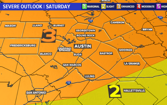
AUSTIN, Texas — After a break from storm chances on Friday, the threat of severe weather returns on Saturday, especially Saturday night into the early morning hours of Easter Sunday.
The risk for severe weather is a 3 out of 5 or an “Enhanced Risk.” The main threats will be from severe storms producing large hail and damaging winds. The tornado threat and flood threat are low at this point.

kvue
Timeline
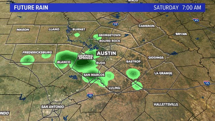
Saturday, 7 a.m. – Saturday morning will feature a chance for a few showers and isolated storms. Temperatures will be in the low 60s.
kvue
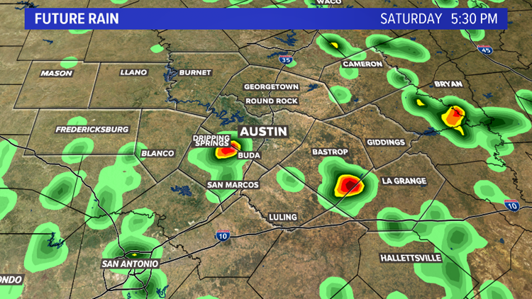
Saturday, 5 p.m. – Isolated storms will be possible for Saturday afternoon. A few storms could be strong, producing gusty winds, hail and cloud-to-ground lightning.
kvue
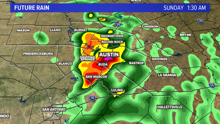
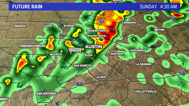
Sunday, 1 a.m – The main severe weather risk will move into the area by late Saturday evening into the overnight hours of Sunday morning. Storms in this time frame could be severe.
kvue
Sunday, 4 a.m. – The severe weather risk continues through the predawn hours of Sunday.
kvue
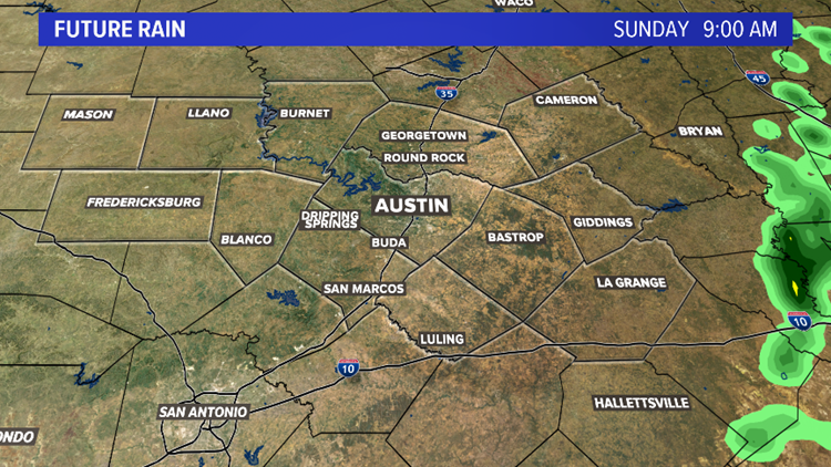
Sunday, 9 a.m. – By mid-morning on Sunday, rain chances will exit the region. Expect clearing skies, mild temperatures and a westerly wind for Easter Sunday afternoon.
kvue
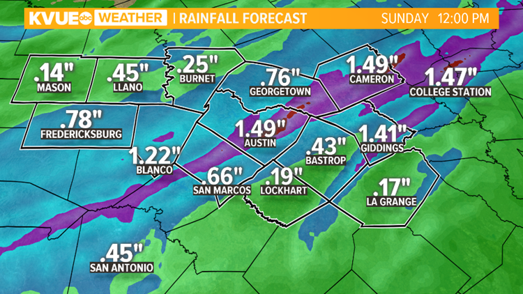
Rainfall amounts could add up to more than an inch in some locations.
kvue
Expect cooler temperatures and drier weather for next week.
PEOPLE ARE ALSO READING:
Coronavirus updates in Central Texas: Texas Gov. Greg Abbott to issue executive order next week
LIST: Austin restaurants selling grocery items
State health worker tests positive for coronavirus, according to internal email