- Early voting for May 28 primary runoff elections will go on, despite storm damage
- Hurricane survival kit: How to keep your family safe when a hurricane hits
- Houston-area storm damage: Update on status of schools, power outages and resources for storm victims
- EF-1 tornadoes ripped through Cypress, Waller County areas with winds at more than 100 mph, NWS reports
- Houston-area storm damage updates: Clean up continues after NWS says two EF-1 tornadoes and powerful derecho ripped through SE Texas
How does Florence compare to past hurricanes? ‘Frankenstorm’ was in a class by itself.

Hurricanes, like people, take on unique personalities as they spin to life. But Hurricane Florence was in a class of its own — so unusual that it defies comparisons to a single past Carolina storm, said a climatologist with the North Carolina Climate Office.
“Florence is going to be remembered as very unique — almost like a Frankenstorm,” applied climatologist Corey Davis said in an interview. “It resembles some aspects of other storms, but over all it’s just a completely different monster.”
Had it maintained its strength before landfall, Davis wrote in an analysis of the storm, Florence would have joined 1954’s Hurricane Hazel as the only Category 4 hurricanes to make landfall in North Carolina.
Forecasters had expected Hazel to stay offshore and weaken, the National Weather Service says. Instead the storm gathered strength as it turned northwest from the Caribbean, lashing the coast with wind speeds of up to 150 mph before making landfall near Calabash, N.C., just north of the Carolinas line. Landfall coincided with the highest lunar tide of the year, producing a storm surge of up to 18 feet.
After Hazel, a Weather Bureau report from Raleigh said at the time, “all traces of civilization on the immediate waterfront between the state line and Cape Fear were practically annihilated.” Brunswick County was hardest hit, with only five of the 357 buildings in one community, Long Beach, left standing.
Florence also achieved that force unusually far north, Davis added. Only the 1933 Chesapeake-Potomac hurricane, among the 33 recorded hurricanes to land in North Carolina, was farther north than Florence as it crossed the longitude of Bermuda, 65 degrees West.
Florence topped Hurricane Floyd of 1999 for the massive inland flooding it caused, but the storms worked their havoc in different ways.
Floyd followed two weeks after Hurricane Dennis, which left the ground saturated and rivers swollen, setting the table for flooding. Then it tore northward, departing quickly like most hurricanes that make landfall in the Carolinas.
Floyd’s track formed a long arc from west to northeast before landing at North Carolina’s Cape Fear, briefly turning seaward again before reaching Long Island, N.Y., the next day, the National Weather Service says. The powerful storm flattened or damaged hundreds of homes in communities including Long Beach, the community Hazel had hit decades earlier.
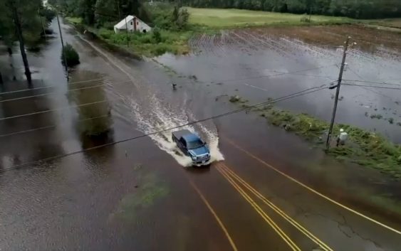
Florence, in contrast, wasn’t the second of two storm punches but stalled near the coast and dumped an estimated 8 trillion gallons of rain. With upper-level high pressure systems surrounding the storm on three sides, Davis wrote, nothing in the atmosphere could steer the storm as it ambled westward.
“Forty-eight hours after Floyd made landfall, it was up in Canada,” Davis said. “Forty-eight hours after Florence made landfall it hadn’t even made it across the state of South Carolina.”
Floyd set a state record for rainfall from a tropical storm, 24 inches in Southport over four days. Florence smashed that record by dropping nearly 36 inches near Elizabethtown, northwest of Wilmington.
Davis most likens Florence to Hurricane Isabel, which hit in 2003, in latitude and intensity. Both became major hurricanes over the central Atlantic hundreds of miles north of the Caribbean, and both weakened as they neared the Carolina coast.
Isabel weakened from a rare Category 5 hurricane to Category 2 by the time it landed on the Outer Banks. Florence, which peaked at Category 4 strength, made landfall early Sept. 14 as a Category 1 hurricane.
Like Isabel, Florence weakened as it neared the coast after an injection of warm air and wind shear — a change in wind speed and direction — shredded the tight eye at its powerful center.
But that’s not what Carolinas residents will tell their grandchildren about Florence, Davis says. They’ll talk about the time a yard of rain fell and Interstate 40 turned into a long, straight river.
Bruce Henderson: 704-358-5051; @bhender