- ReadyBrunswick Hurricane Expo held in Bolivia
- Why the end of El Niño could spell an active hurricane season
- Flooding in South Florida grounds flights, strands Saint Augustine student and others
- After rare flash flood emergency, Florida prepares for more heavy rainfall in coming days
- Centers flooding state leaders with calls pushing for child care funding
Live radar, updates: Tornado Watch issued for parts of the KVUE area
Burnet, Williamson, Milam, and Lee counties are under a Tornado Watch until midnight.
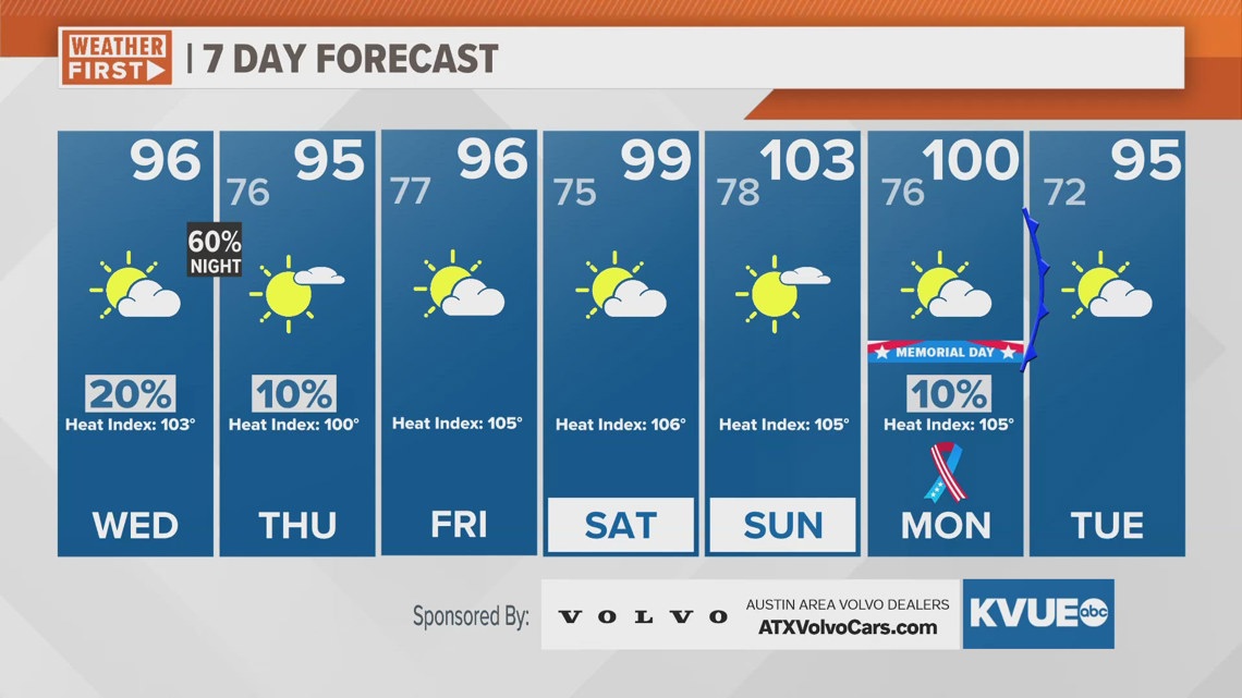
AUSTIN, Texas — While the majority of Central Texas will not see rain this week, stormy weather will favor a few of us.
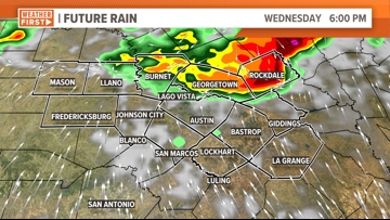
As the influx of humidity off the Gulf of Mexico continues and a few shortwaves are set to push west to east over Texas this week, organized storms may clip our northern borders over the next few nights.
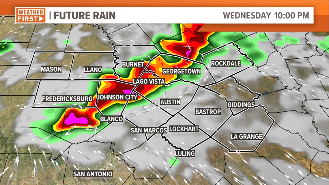
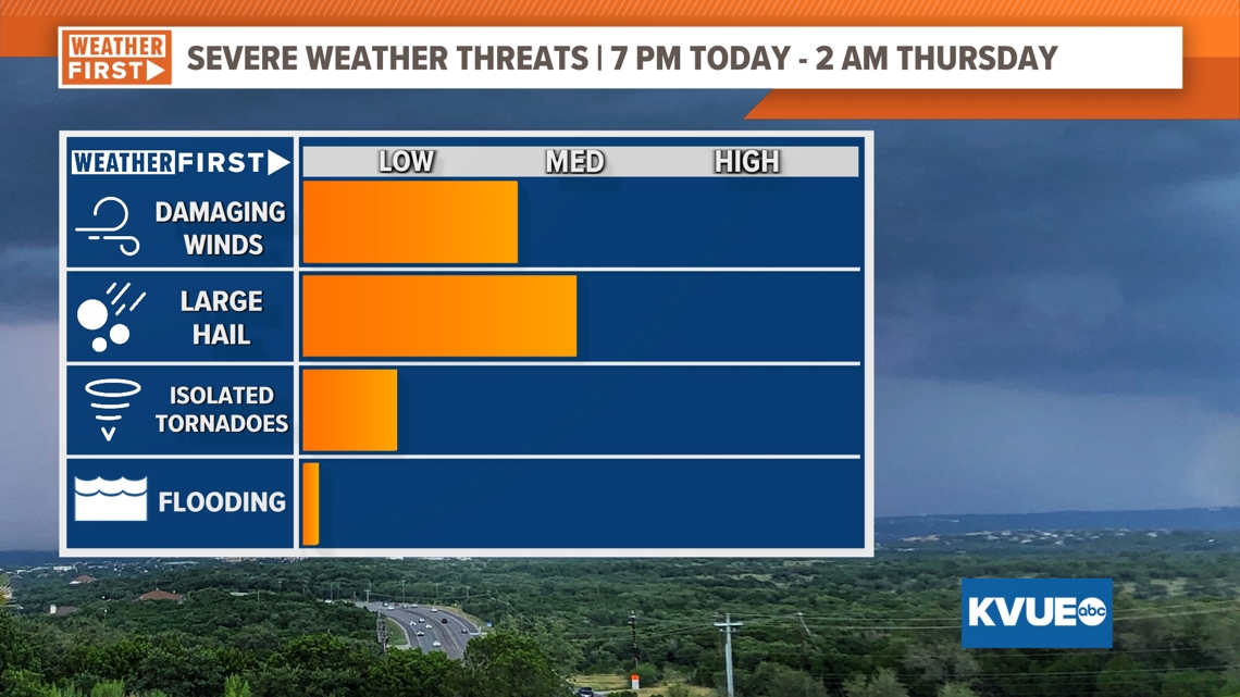
While there was a conditional risk for storms Tuesday evening that failed to materialize, our more significant risk for strong storms will be Wednesday evening, primarily between 5-6 p.m. and 2 a.m. Thursday. From the model below, you can see these storms will be scattered to widespread and could make a run at the Austin metro by around 10 p.m., but not before a first round of storms impacts some of our northern counties earlier in the evening.


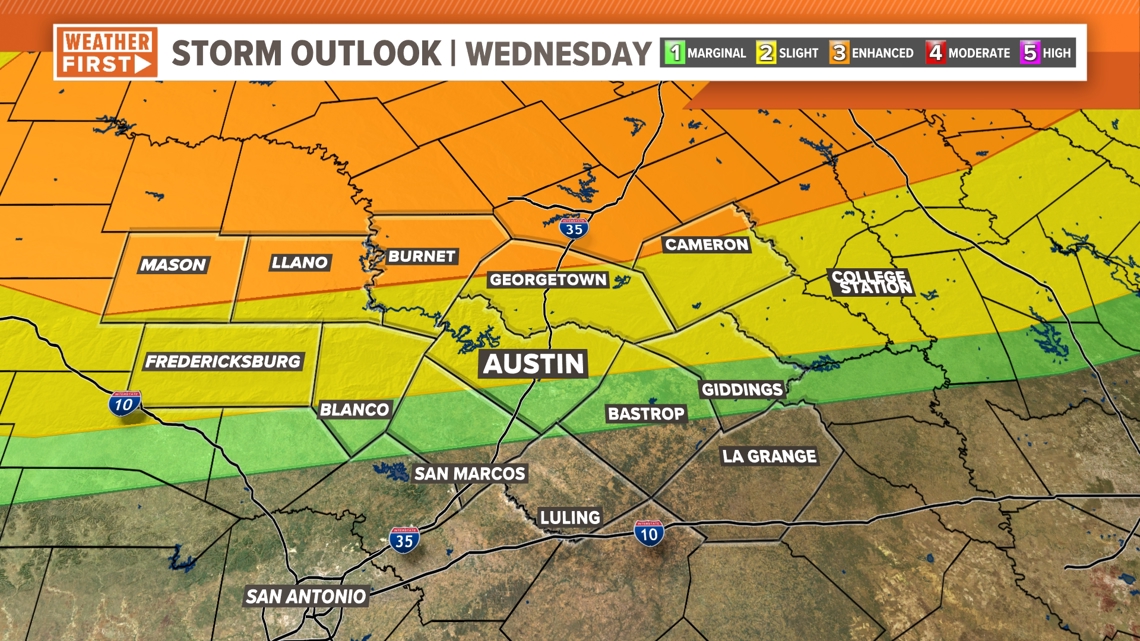
The Storm Prediction Center increased the risk for our northern Hill Country counties to an “enhanced” – level 3 out of 5 – risk for severe weather. most of the remainder of Central Texas falls under either a level 1 or 2 risk, and places like San Marcos and Luling not under any severe risk at all.

The main concerns will be large to very large hail, damaging wind and isolated tornadoes. The most recent timeline is between 7 p.m. Wednesday through 2 a.m. Thursday.

Rain chances drop back down to 10% or below as we shift into Memorial Day weekend.